EO Data Sources
(EO4GEO - Faculty of Geodesy University of Zagreb)Earth Observation Data
- Earth observation data - unique source of information.
- It can be combined with administrative, social and economic data at multiple scales for in-depth policy analysis.
- Earth observation from satellites, aircrafts and drones, in-situ measurements or ground-based monitoring stations, can provide a unique and timely source of data that is commensurable across countries, regions and cities.
- It can help harmonise international reporting on natural resources, ecosystems and environmental risks.
Main Data and Product Providers
- European Space Agency
- NASA’s Earth Observing System Data and Information System (EOSDIS)
- Data Integration and Analysis System (DIAS, Japan)
- Planet Labs Inc.
Global Earth Observation System of Systems
- The Group on Earth Observation (GEO) is a partnership of 104 national governments plus the European Commission and 118 Participating Organizations.
- GEO implements a Global Earth Observation System of Systems (GEOSS) and envisions a future where decisions and actions for the benefit of humankind are informed by coordinated, comprehensive and sustained Earth observations. https://ec.europa.eu/info/sites/info/files/eurogeoss/eurogeoss_concept_paper-2017.pdf
- EuroGEO will not develop new resources.
- Instead, it will bring together existing ones and enable them to work more effectively.
Parts of Copernicus used by EuroGEO
- Copernicus Servicesand their products for monitoring land, oceans, atmosphere and climate.
- Copernicus Data and Information Access Services (DIAS).
- Other sources of Copernicus data
- Copernicus contributing missions – other space mission operators that make some of their data available for Copernicus
- The Copernicus Relays – a network of ambassadors who coordinate and promote the Copernicus programme
- Academy networks
- Copernicus incubation programme – a programme that promotes start-up creation and growth
Copernicus Services
Copernicus Services
Other resources
European Observation Resources
- The Infrastructure for Spatial Information in Europe (INSPIRE) enables the sharing of environmental spatial information among public sector organisations
- The EU Open Data Portal gives access to all open data published by EU institutions and bodies – including observation data
Other resources
Global Earth observation resources
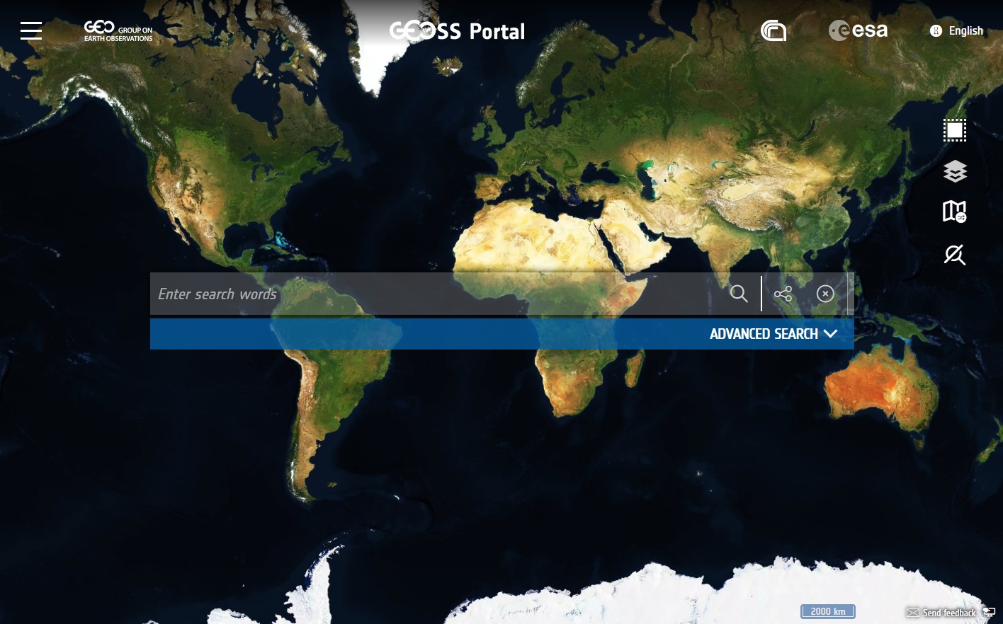
- GEOSS Common Infrastructure allows users of Earth observations to search and use the data, information, tools and services available through the Global Earth Observation System of Systems.
- Use the GEOSS web portal to look up Earth observation data.
Agencies and organisations
- European Space Agency
- EUMETSAT - a global satellite agency at the heart of Europe
- European Centre for Medium-Range Weather Forecasts
- Mercator-Ocean
NASA Earth Observation Data
- NASA promotes the full and open sharing of all its data to research and applications communities, private industry, academia, and the general public.
- In order to meet the needs of these different communities, NASA’s Earth Observing System Data and Information System (EOSDIS) has provided various ways to discover, access, and use the data.
- You can also discover data for various instrument measurements by scientific discipline or get information on the application of certain datasets to a given topic through our data pathfinders.
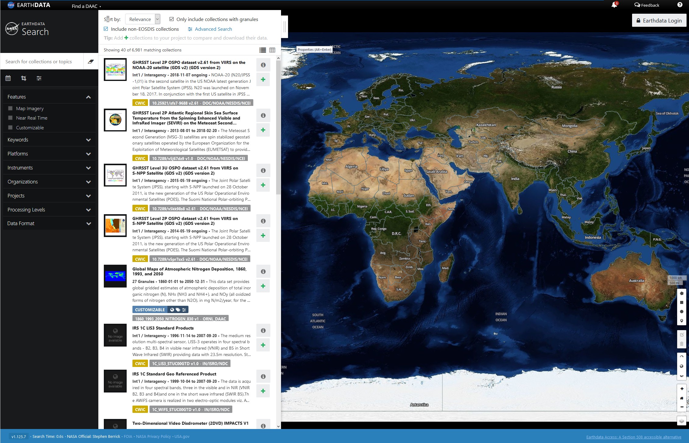
NASA - Find Data
- There are several different web-based options for searching and downloading datasets from all of NASA’s data collections.
- Search by keyword or instrument, geographical or temporal extents, and more through Earthdata Search;
- Discover near real-time data through the Land, Atmosphere Near real-time Capability for EOS (LANCE) and the Fire Information for Resource Management System (FIRMS);
- Use the Common Metadata Repository (CMR), a metadata system that catalogs Earth Science data and associated service metadata records; or
- Browse data and services through the Global Change Master Directory (GCMD).
NASA - Use Data
- Discover tools and techniques for accessing, subsetting, filtering, visualizing, mapping, and analyzing data.
- Data recipes, pathfinders, and webinars provide guidance on how to use NASA data and tools.
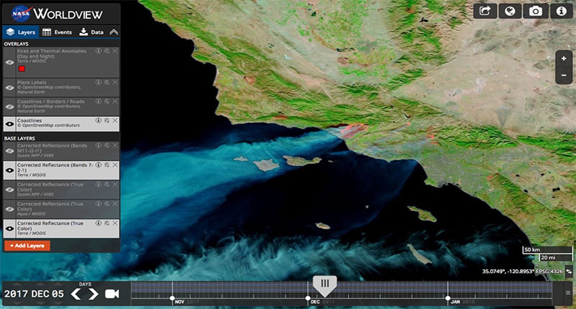
NASA - Visualize Data
- Someone will find several ways to find or create visual representations of the data.
- Much of the instrument data is returned as quantitative values; to help users understand the data, EOSDIS has developed several ways to visualize the information.
- Worldview — an interactive web-based tool providing access to full-resolution, global satellite imagery.
- Worldview Snapshots — a lightweight tool for creating image snapshots from a selection of popular NASA satellite imagery layers.
- Global Imagery Browse Services (GIBS) — allows you to obtain imagery through your own client application by way of standards-based web services and formats.
Planet Imagery and Archive
- Planet provides geospatial insights at the speed of change, equipping organizations with the data necessary to make informed, timely decisions.
- Someone can monitor areas of interest, validate information on the ground, and discover trends relevant to his organization.
- Planet operates more than 150 satellites that together provide an unprecedented dataset of Earth observation imagery.
Data Integration and Analysis System (DIAS, Japan)
- DIAS is an infrastructure for collecting and analyzing Earths Observations and socio-economic data to solve global environmental issue.
- The goals of DIAS are:
- to collect and store earth observation data;
- to analyze such data in combination with socio-economic data, and
- convert data into information useful for crisis management with respect to global-scale environmental disasters, and other threats;
- and to make this information available within Japan and overseas.
(Some) Primary Image Sources
- DIAS is an infrastructure for collecting and analyzing Earths Observations and socio-economic data to solve global environmental issue.
- USGS Earth Explorer - Satellite images, aerial photos, maps, and much more
- GloVIS - USGS Global Visualization Viewer, a primary site for Landsat and ASTER
- NASA Earthdata Search - Access most NASA data - MODIS Land products, ASTER, AVHRR, other data
- USGS Satellite Image Catalog - A list of the types of satellite images offered by the USGS
- LandsatLook Viewer - USGS browse for Landsat images from January 1999 to present - JPEG images only
Ocean Data
- National Oceanographic Data Center
- NOAA IOOS - Integrated Ocean Observing System
- NOAA Coastwatch - Great lakes Region
- Ocean Color Products from NASA - MODIS and SeaWiFS
- Remote Sensing Systems (RSS) - Various enhanced research data for oceans
- Northeast Ocean Data - From the Northeast Regional Ocean Council
Atmosphere Data
- OCO-2 - Orbiting Carbon Observatory-2 - JPL
- AIRS - Atmospheric Infrared Sounder
- AURA - Atmospheric Chemistry
- GOSAT - Greenhouse Gases Observing Satellite "IBUKI"
- SCIAMACHY - SCanning Imaging Absorption spectroMeter for Atmospheric CHartographY
- CALIPSO - Profile observations of cloud and aerosols and IR imagery
Snow and Ice
- NSIDC - National Snow & Ice Data Center - snow cover and sea ice products
NDVI Data
- Global SPOT Vegetation data - 10-day composites from 1998 at 1 km resolution
- GLFC data for the U.S. - 16-day composites from 2001 at 250 m resolution
- MODIS Data Subsets - MODIS Land Product time-series subsets - NDVI as well as other data
LiDAR
- USGS LiDAR - USGS LiDAR Information page
- CLICK - USGS Center for LiDAR Information Coordination and Knowledge - link no longer working
- FUSION - USFS and U. of Washington LiDAR visualization software
- rapidlasso GmbH - Open source LAStools utilities
- LiDAR Links - Where to find LiDAR data
- NASA G-LiHT - NASA Goddard LiDAR, Hyperspectral & Thermal Imager (and data)
Commercial Image Distributors
- DigitalGlobe - QuickBird, Ikonos, GeoEye and WorldView (resolution under 1m )
- DigitalGlobe Foundation - Satellite imagery grants for academic research
- SPOT Image catalog - Search for data online
- Astrium - Part of Airbus Defence and Space for SPOT & other European data
- Swedish Space Corporation
Remote Sensing Earth Observation Directory
- A list of interesting websites, browsers, books, data sources, etc in Remote Sensing / Earth Observation (RS/EO)
- RS/EO directory is just another website (based on GitHub pages) where you can find some useful resources in Remote Sensing (RS) & Earth Observation (EO).
http://joaogoncalves.cc/Remote-Sensing-Earth-Observation-directory/
Commercial Satellite Data
- Airbus Satellite Imagery (https://www.intelligence-airbusds.com/optical-and-radar-data/)
- ASTRO DIGITAL (https://astrodigital.co)
- DigitalGlobe (https://www.digitalglobe.com/)
- Planet Labs (https://www.planet.com/)
- SkyWatch / Techstars (https://www.skywatch.com/)
- Urthecast (https://www.urthecast.com/)
http://joaogoncalves.cc/Remote-Sensing-Earth-Observation-directory/
Free satellite data
- Multi-platform
http://joaogoncalves.cc/Remote-Sensing-Earth-Observation-directory/
Free satellite data: Multi-platform
- Planet Explorer Beta link
- Rocket EO data browser link 1 link 2
- Sinergise EO Browser link
- USGS EarthExplorer link
- USGS GloVis link
- Vertex - Alaska Satellite Facility (ASF) Data Portal link
- Vito Data Portal link
http://joaogoncalves.cc/Remote-Sensing-Earth-Observation-directory/
Free satellite data: Sentinel
- Awesome Sentinel curated list of Sentinel-related tools, tutorials and API’s link
- BOKU Sentinel-2 data pre-processing service link
- ESA SciHub Sentinels Data link
- IPSentinel - Sentinel data hub for Portugal link
- Sentinel-2 World cloudless mosaic browser link
- Theia/CNES Sentinel-2 data pre-processing service link
http://joaogoncalves.cc/Remote-Sensing-Earth-Observation-directory/
Free satellite data: Landsat & MODIS
- Landsat
- Modis
- MODIS Web Earth Observation Monitor (webEOM) link
http://joaogoncalves.cc/Remote-Sensing-Earth-Observation-directory/
RS/EO-based data sets, data sources and ‘high-level’ products (1)
- Digital Elevation/Surface Models
- ASTER GDEM Elevation data link 1 link 2
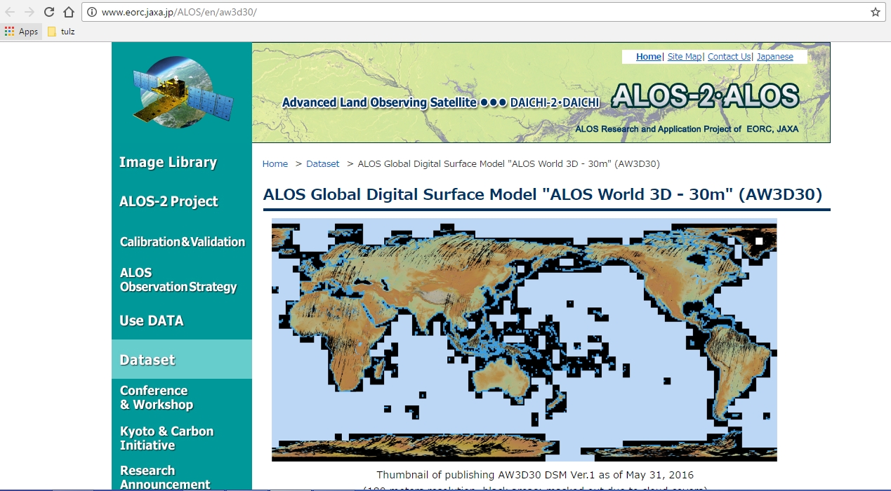
- JAXA ALOS Global Digital Surface Model “ALOS World 3D - 30m” (AW3D30) link
- Land cover / land use
- Fused data sets
- Harmonized Landsat / Sentinel data link
- Fires
- Global Fire Emissions Database, Version 4.1 (GFEDv4) link
http://joaogoncalves.cc/Remote-Sensing-Earth-Observation-directory/
RS/EO-based data sets, data sources and ‘high-level’ products (2)
- Forest data layers
- Surface Temperature
- Sea Surface Temperature link
http://joaogoncalves.cc/Remote-Sensing-Earth-Observation-directory/
RS/EO-based data sets, data sources and ‘high-level’ products (3)
- Multiple themes (land cover, vegetation, water, energy, climate, …)
- Copernicus Land Monitoring Service and high-level products link
- ESA Climate Change Initiative (CCI) / Open Data Portal link
- EarthEnv (global environmental layers for assessing status and trends in biodiversity, ecosystems, and climate) link
- NOAA/EOG/NCEI (nighttime observations of lights and combustion sources worldwide) link
- SEDAAC (Socioeconomic Data and Applications Data Center) datasets (mangroves, fires, urban extent, demography, etc) link
- WCMC-UNEP datasets (biodiversity, SST, ecoregions, protected areas, mangrove ecosystems, marine species, coral reefs, …) link
http://joaogoncalves.cc/Remote-Sensing-Earth-Observation-directory/
Top 20 Free Satellite Imagery Data Sources (1)
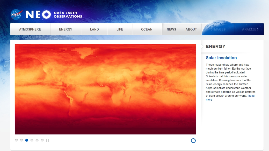
- NASA Earth Observations (NEO)
- NASA’s Earth Observations (NEO) strives to make global satellite imagery very accessible to all users. It is the best when it comes to accessing our local environment daily from space with over 50 global datasets from atmosphere, energy, land, life, ocean and a whole lot more.
Top 20 Free Satellite Imagery Data Sources (2)
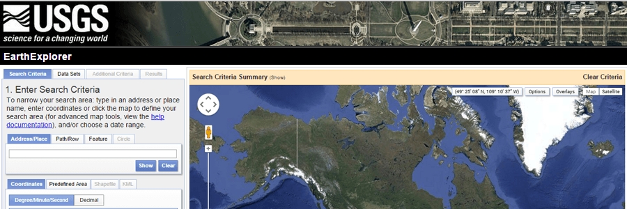
- USSG Earth explorer
- The USGS Earth Explorer remains an incredibly rich imagery data source from the remotest to the most urban location, anywhere around the world. For a number of reasons, USGS stands tallest in the provision of abundant free satellite images.
Top 20 Free Satellite Imagery Data Sources (3)
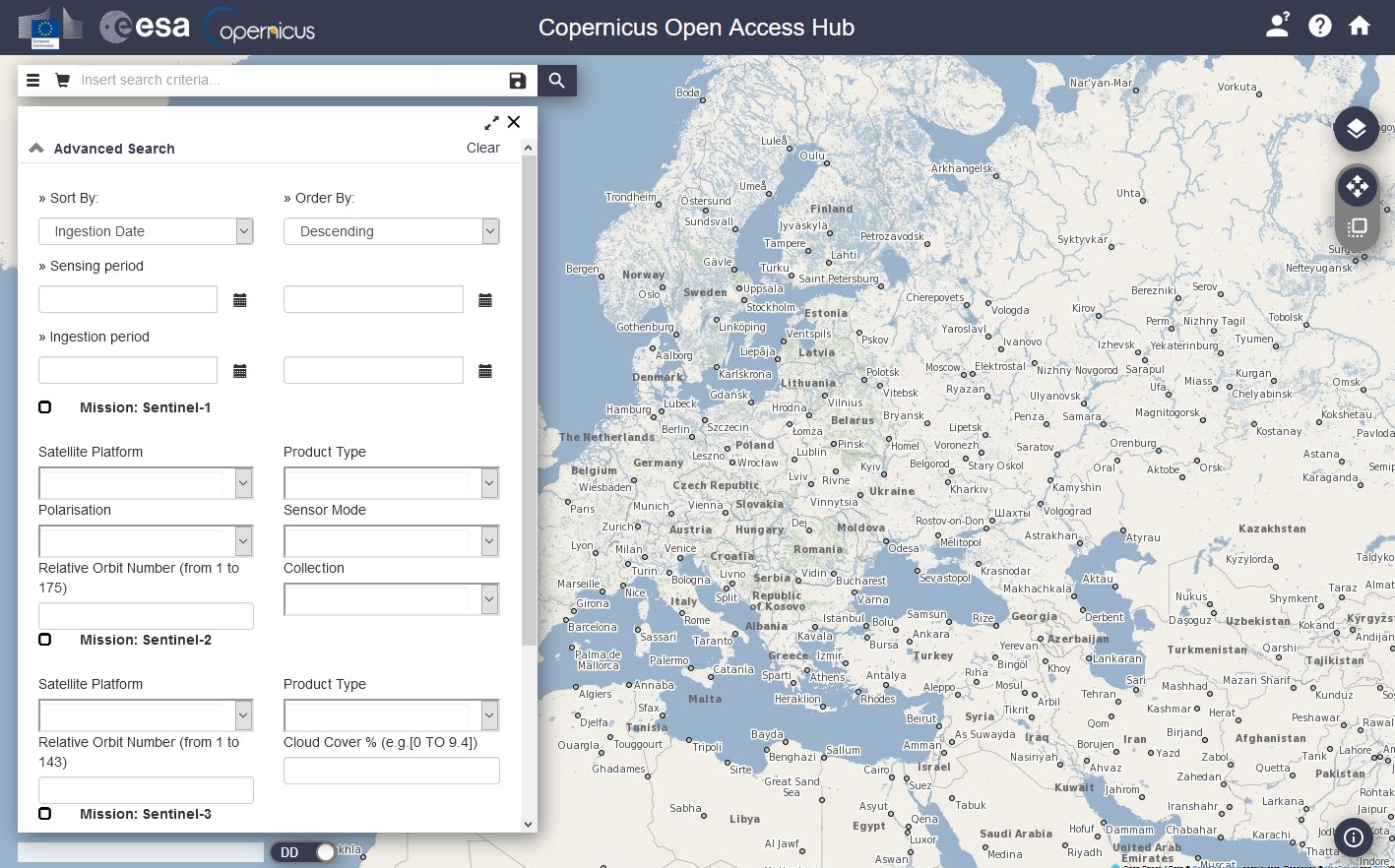
- ESA’s Sentinel Satellite data
- The official download headquarters for the European Space Agency’s Sentinel satellite data, Sentinel’s Scientific Data Hub.
- ESA’s Copernicus Programme - five earth observing satellites made possible by tool box – sentinel-2 further increases the source of acquiring data remotely from ESA’s.

Top 20 Free Satellite Imagery Data Sources (4)
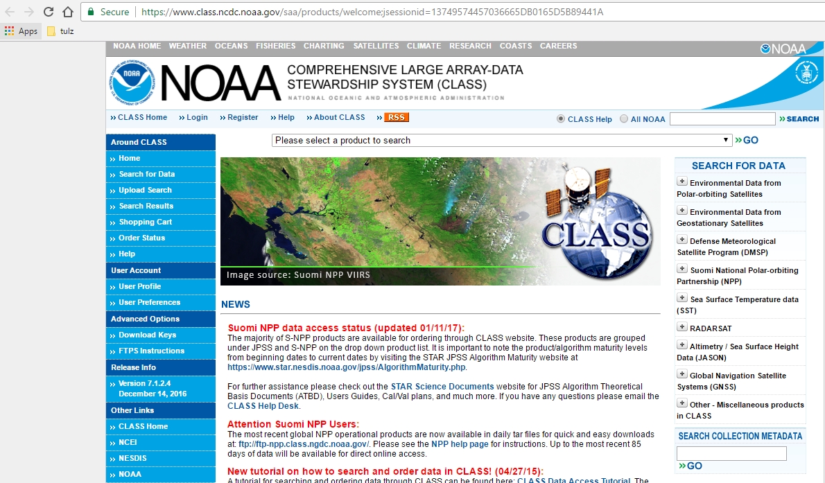
- NOAA (National Oceanic and Atmospheric Administration) Class
- The Comprehensive Large Array-data Stewardship System (CLASS) is really in a class of its own with abundance of data accumulated from other rich and viable sources such as the US Department of Defense (DoD) Polar-orbiting Operational Environmental Satellite (POES), Environmental Satellite (GOES), NOAA’s Geostationary, Operational), and other derived data.
https://thewaternetwork.com/_/geographic-information-systems-gis/
Top 20 Free Satellite Imagery Data Sources (5)
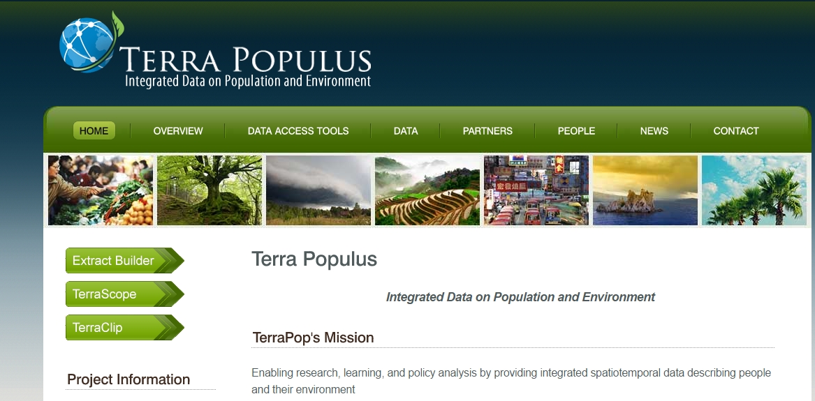
- Terra Populus
- Terra Populus ability to integrate population and environmental data from over 160 countries around the world makes it very unique.
- It combines spatiotemporal data covering population counts and surveys, satellite imagery of land cover, weather station data, Land use data.
https://thewaternetwork.com/_/geographic-information-systems-gis/
Top 20 Free Satellite Imagery Data Sources (6)
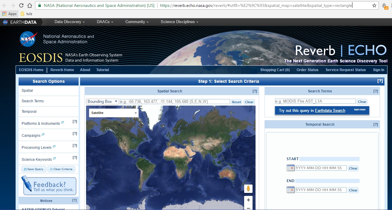
- NASA Reverb
- NASA’s Reverb Data Hub - NASA Reverb communicates with a plethora of satellites such as NASA DC, GPS satellites, SMAP, JASON, METEOSAT, ALOS, TRMM, Aura, Aqua and much more.
- Tutorial for gain easy access to NASA Reverb Hub. (https://www.youtube.com/watch?v=ozbDfWnz9eg)
https://thewaternetwork.com/_/geographic-information-systems-gis/
Top 20 Free Satellite Imagery Data Sources (7)
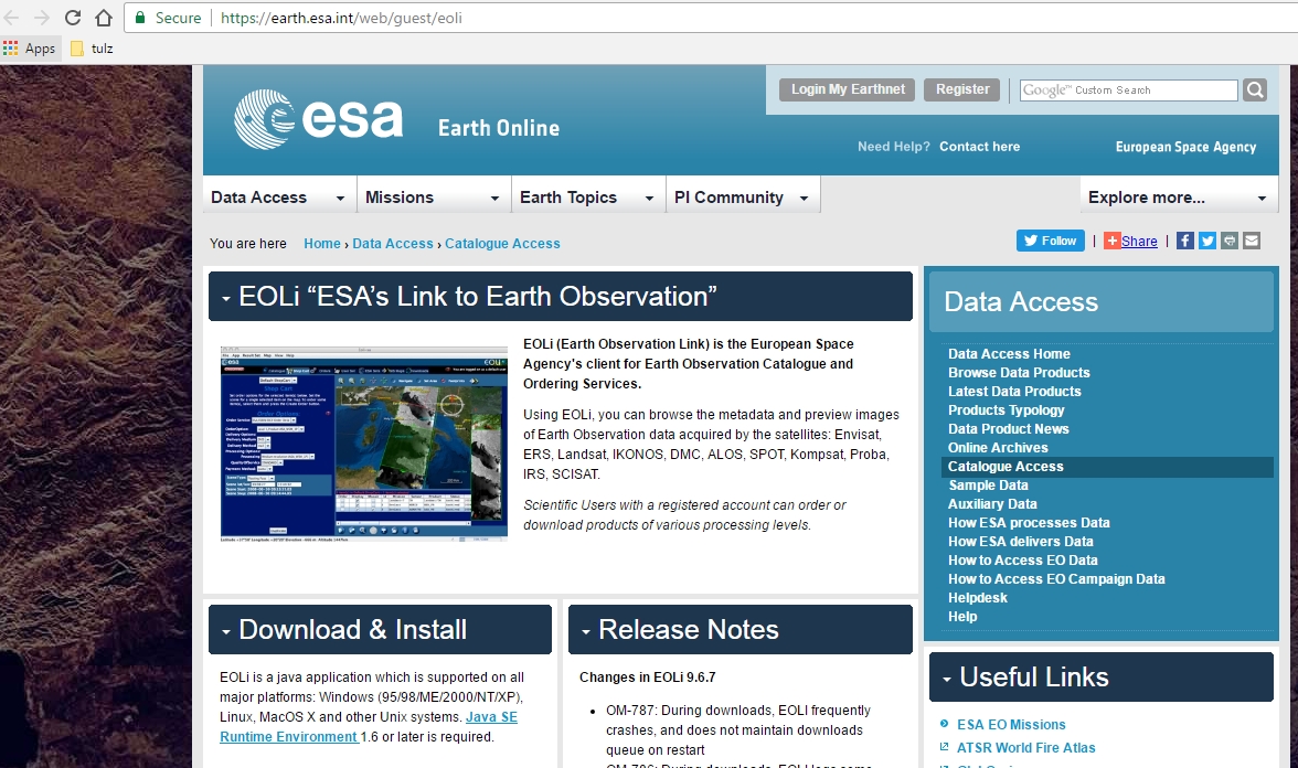
- Earth Observation Link (EOLi)
- The Earth Observation Link (EOLi) is the European Space Agency’s client for Earth Observation Catalog and Ordering Services.
https://thewaternetwork.com/_/geographic-information-systems-gis/
Top 20 Free Satellite Imagery Data Sources (8)
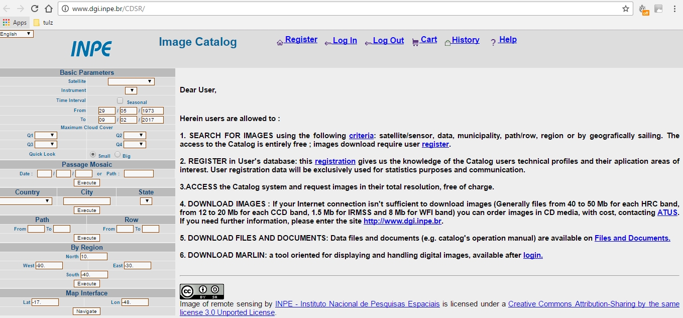
- National Institute for Space Research (INPE)
- INPE Image Catalogue is combined satellite image source from Brazil and China which lets you download free satellite imagery data from their remote image catalog. In addition to their own Earth Resources (CBERS-2, CBERS-2b), they also tap into satellites of United States, United Kingdom as well as the Indian (Landsat, CBERS, Aqua, S-NPP) satellites.
https://thewaternetwork.com/_/geographic-information-systems-gis/
Top 20 Free Satellite Imagery Data Sources (9)
- JAXA’s Global ALOS 3D World
- the JAXA Global ALOS link - a 30-meter spatial resolution digital surface model (DSM) released for public access invented by the Japan Aerospace Exploration Agency’s (JAXA).
- Its great precision in global-scale elevation data using the Advanced Land Observing Satellite “DAICHI” (ALOS) – PALSAR’s L-band makes it very unique.
https://thewaternetwork.com/_/geographic-information-systems-gis/
Top 20 Free Satellite Imagery Data Sources (10)
- NOAA Data Access Viewer
- At NOAA Data Access Viewer someone cannot only find and download definitive datasets, there also given the flexibility to customize it, all free.
https://thewaternetwork.com/_/geographic-information-systems-gis/
Top 20 Free Satellite Imagery Data Sources (11)
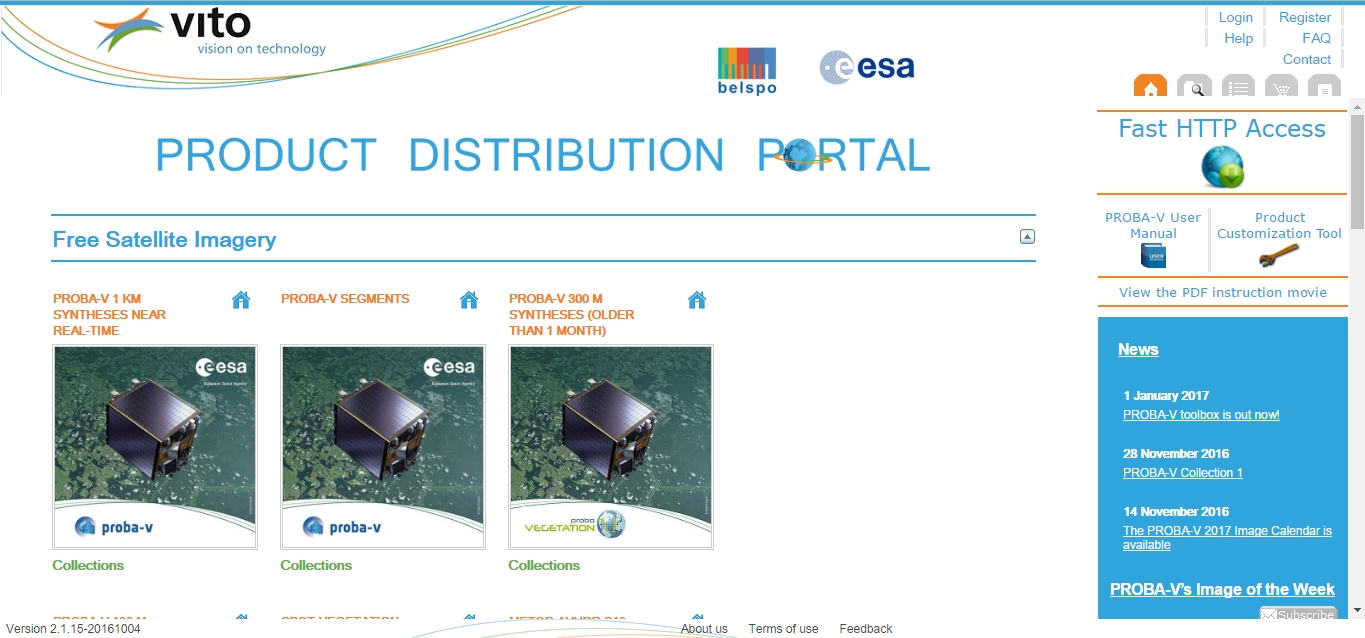
- VITO Vision
- VITO Vision is a coarse resolution satellite best adapted for large scale applications.
- It offers free satellite images which map out the Earth surface’s vegetation patterns.
- They are SPOT-Vegetation, PROBA-V and METOP.
https://thewaternetwork.com/_/geographic-information-systems-gis/
Top 20 Free Satellite Imagery Data Sources (12)
- DigitalGlobe Free Product Samples
- Free satellite imagery samples can also be found in DigitalGlobe, which ranks as the largest and sharpest commercial satellite data supplier in the world.
https://thewaternetwork.com/_/geographic-information-systems-gis/
Top 20 Free Satellite Imagery Data Sources (13)
- NOAA Digital Coast
- NOAA’s Digital Coast - coastal data.
- The range of free satellite imagery dataset such as infrared, radar and true color composite can be download.
- It provide also imagery, land cover, elevation, socio-economic and benthic data.
https://thewaternetwork.com/_/geographic-information-systems-gis/
Top 20 Free Satellite Imagery Data Sources (14)
- Global Land Cover Facility
- Landcover.org - land cover data and land cover changes around the world (MODIS, AVHRR and Landsat satellite imagery)
- Global Land Cover Facility encompassing both geologic, agriculture, hydrologic, vegetation, and urban areas on the earth’s surface.
https://thewaternetwork.com/_/geographic-information-systems-gis/
Top 20 Free Satellite Imagery Data Sources (14)
- BlackBridge/Geo-Airbus
- Some satellites such as RapidEye, SPOT, and TerraSAR data are specific to some fields like oil & gas, security, agriculture, environment, disaster mapping, mining and energy.
- Blackbridge provides these specific satellites for Canadians only while Airbus Defense Systems provides for the rest of the world.
- Sample data can be downloaded in some of the locations:
https://thewaternetwork.com/_/geographic-information-systems-gis/
Top 20 Free Satellite Imagery Data Sources (15)
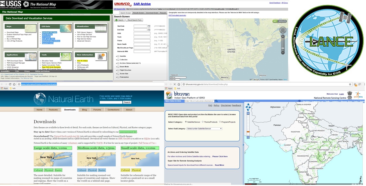
- The National Map Viewer and Download Platform (Topographic Information)
- UNAVCO Research Data (the UNAVCO SAR Archive)
- LANCE: NASA NEAR REAL-TIME DATA AND IMAGERY (this link)
- Natural Earth’s Data (Natural Earth Data)
- Bhuvan Indian Geo-Platform of ISRO (Bhuvan Indian Geo-Platform)
https://thewaternetwork.com/_/geographic-information-systems-gis/