Early Warning for Mosquito-borne epidemics at regional level
Laboratory of Atmospheric Physics, University of Patras (UPAT)Centre of EO Research and Satellite Remote Sensing (BEYOND)
Introduction
...leveraging scientific knowledge and ultimately provin that Earth Observation can spend our understanding in the field of Epidemics...Agenda
- The BEYOND EO Center/EuroGEO Action Group on Vector-borne Diseases
- State-of-the-art in the field of epidemics
- Development of an Early Warning Decision Support System in Europe
- Human infectious disease modeling related to climatic change conditions
- Exploitation of satellite-based EO for Epidemics of mosquito-borne diseases
- The Modeling Framework and validation of an early warning system at municipal (Greece) and regional (Venneto, Italy) level
Learning outcomes
- Know about the development of an early warning system
- Understand how EO data used to forecast human cases
- Explain the application of an early warning system and its benefits on disease outbreaks
Laboratory of Atmospheric Physics
 |
Research Axes
|
The Space/Geospatial Sector Skills Alliance
Towards an innovative strategy for skills development and capacity building in the space geo-information sector supporting Copernicus User Uptake

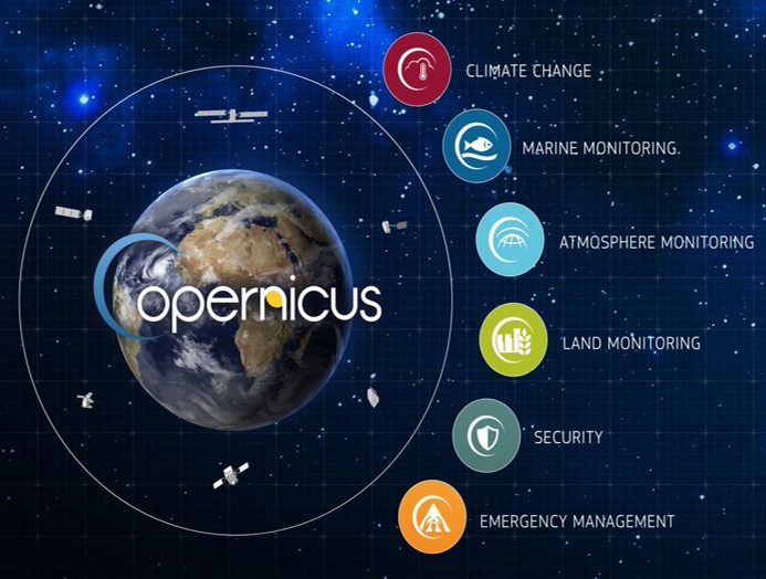
Copernicus Program:
Europe's eyes on Earth
 |
|
The EO4GEO project
- Duration: 4 years from January the 1st, 2018
- Budget: 3,87 million €
- Partnership: 25 Partners + 30+ Associated Partners (from 16 EU Countries) from Academia, Companies and networks
- Coordinators: GISIG (General), KU Leuven (Scientific & Technological), PLUS (Education & Training), Climate-KIC (Exploitation)
The EO4GEO project
- EO4GEO aims to bridge the skills gap between the supply and demand of education and training in the space/geospatial sectors, fostering the uptake and integration of space/geospatial data and services in a broad range of application domains.
- EO4GEO works in a multi and interdisciplinary way and apply innovative solutions for its education and training actions: case-based and collaborative learning scenarios; learning-while-doing in a living lab environment; on-the-job training and co-creation of knowledge, skills and competencies.
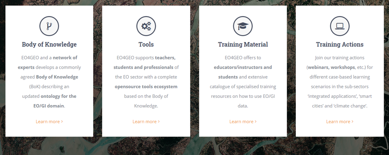
EO4GEO IS MUCH MORE
EO4GEO offers a series of tangible results that are usable for the broader EO/GI education/training community
Early Warning for Mosquito-borne epidemics at regional level
Let's start from the basics...
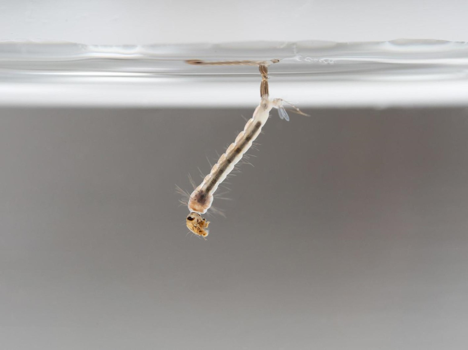
Mosquito-Borne Diseases in Europe
An emerging threat
Mosquitos & Diseases
|
|
EUROGEO
Action Group
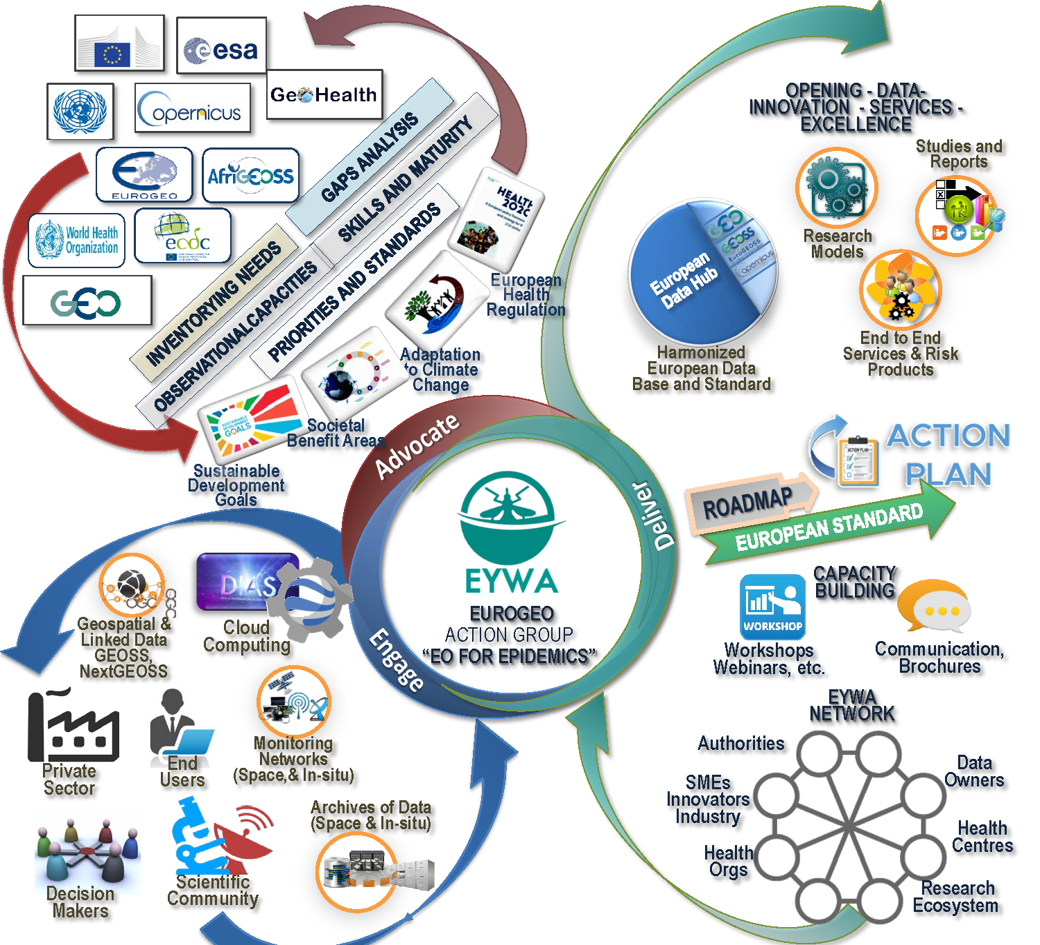
EYWA is a vision, a network, a European and even global standard.
EYWA offers a scalable, reliable and sustainable early warning system, relying on Earth observation big data combined with entomological, epidemiological and socioeconomic data, to forecast and monitor Mosquito-Borne Diseases.
EYWA
|
EYWA is built on the triptych: |
EYWA
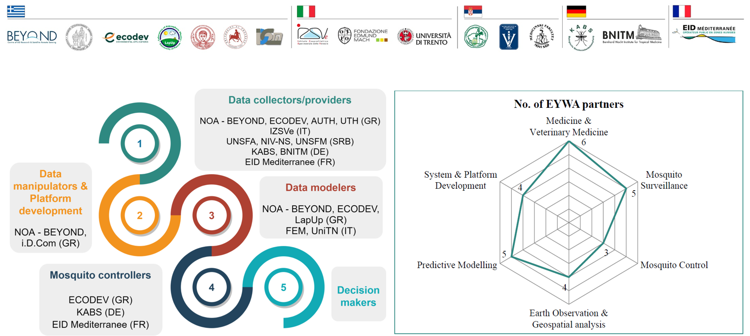
EYWA TEAM
"Together Everyone Achieves More"
How EYWA competes?
EYWA is a robust and scalable Early Warning & Decision Support System that welcomes new partners from around the world to share data and transform scientific knowledge into decision-making & mosquito control actions
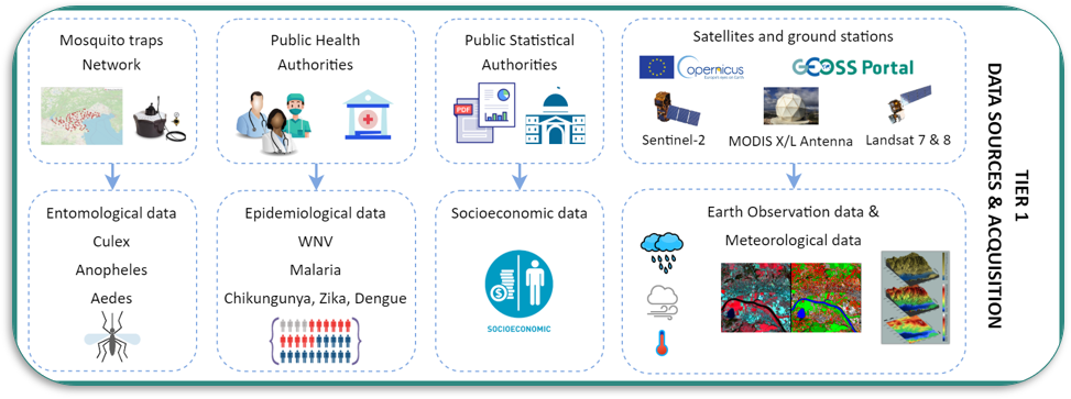
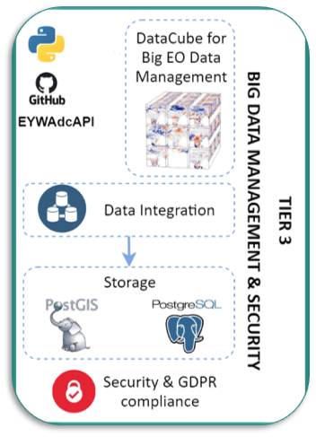
EYWA system architecture
EYWA incorporates 10-years time-series of Copernicus (Sentinel-2) and other space-based data (Landsat-7 & -8, MODIS and ERA-5) in addition to in-situ entomological, epidemiological, socioeconomic and crowdsourcing data.
EYWA system architecture
|
|
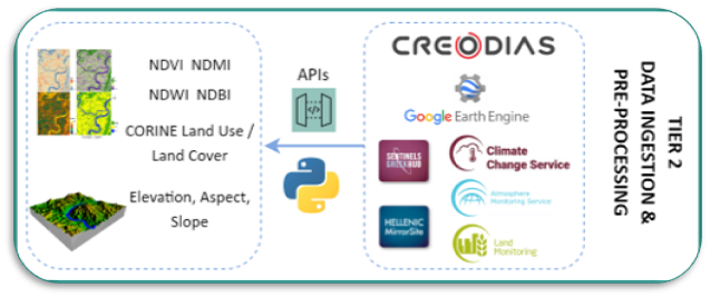
- Satellite data harvesting and processing, exploiting European and non-European services:
- Umbrella Sentinel Access Point of the Hellenic Mirror Site (an API that constitutes 100% EU innovation and has been developed by BEYOND-NOA in the framework of the NextGEOSS and EOPEN EU projects)
- CreoDIAS and Google Earth Engine
EYWA system architecture
|
|
EYWA system architecture
|
|
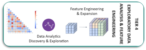
How is this plethora of independent data transformed into meaningful scientific knowledge?
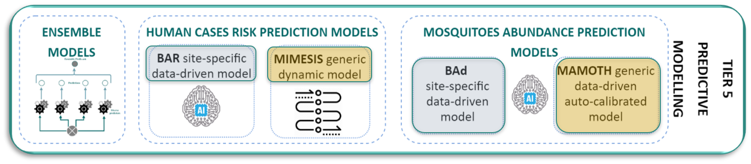
EYWA has a factory of dynamic and data-driven models, learning about the dynamics of mosquitoes’ abundance and mosquito-borne diseases transmission, and providing monthly, weekly, daily predictions.
EYWA system architecture
the MAMOTH model
- MAMOTH (Mosquitoes Abundance prediction Model autO-calibrated from features pleTHora)
- Generic data-driven approach relying on open EO data
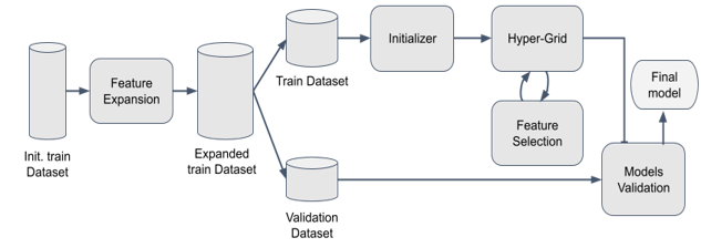
- Automated Feature Selection:
- No human bias on feature selection is injected in the model
- Transferable and replicable
- Knowledge expansion: Operating under the same architecture and the same mathematical principles to different cases, offers extensive capability of comparative studies, responding to: "which characteristics seem important in one case and which on the other?"
- MAMOTH is composed of 32 (up to now)in-housed developed Python functions that are organized in 5 operational Modules
EYWA system architecture
Predictions results dissemination to the relevant Public Health Authorities through monthly reports and the EYWA Web Platform
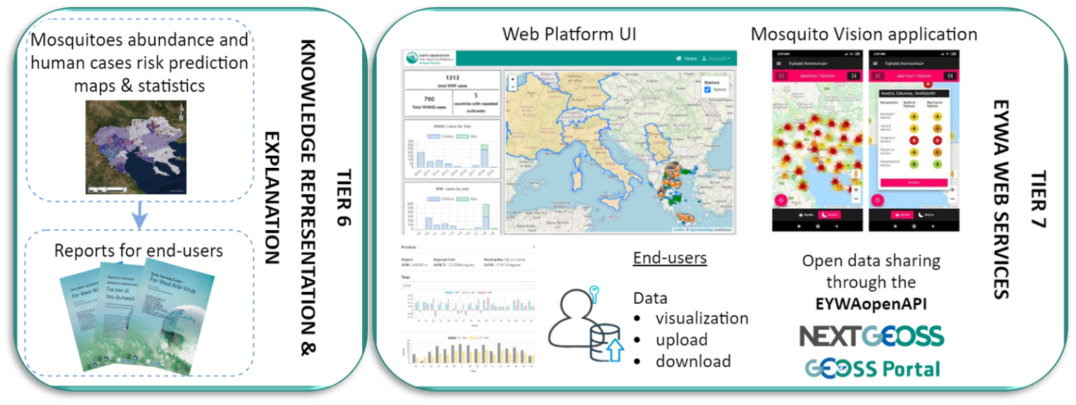
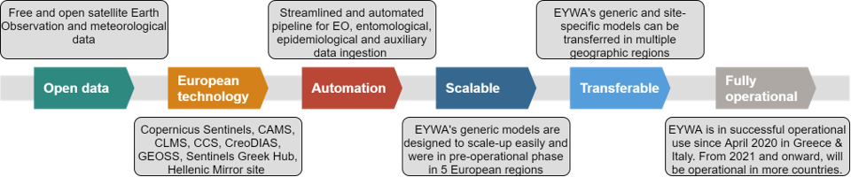
EYWA & open data sharing

EYWA is an autonomous European Initiative, building upon the Open Innovation, Open Science and Open to the World vision for Europe.
- Analysis ready 10-years’ time-series of environmental, meteorological and geomorphological data for every mosquito-traps network in 10 European regions. Accessible through:
- The EYWAopenAPI
- NextGEOSS DataHub

EYWA in action
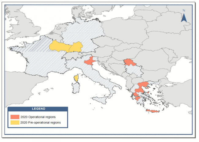
EYWA’s operational implementation in 2020 (TRL>7 ) with a demonstrated impact in:
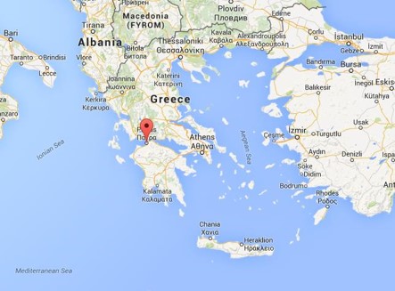
- Greece (Regions of Central Macedonia, Thessaly, Western Greece and Crete)
- Italy (Veneto region)
forecasting Culex mosquito populations and West Nile Virus outbreaks in 2020.
EYWA’s pre-operational test in 2020 for:
- Culex (WNV) abundance prediction in Serbia (Vojvodina region) and Germany (Baden-Württemberg region)
- Anopheles (Malaria) in Italy (Veneto region)
- Aedes albopictus (Chikungunya, Dengue, Zika) in France (Grand Est and Corsica regions)
- Greece (Regions of Central Macedonia, Thessaly, Western Greece and Crete)
- Italy (Veneto region)
- Culex (WNV) abundance prediction in Serbia (Vojvodina region) and Germany (Baden-Württemberg region)
- Anopheles (Malaria) in Italy (Veneto region)
- Aedes albopictus (Chikungunya, Dengue, Zika) in France (Grand Est and Corsica regions)
EYWA in action
|
|
EYWA in action
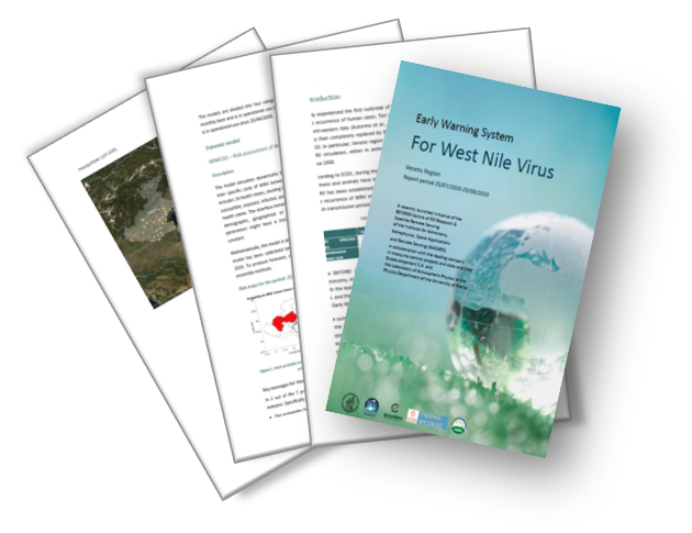
Reports with operational results
- EYWA produces knowledge in the form of reports, statistics, validated assessments and web GIS information layers, all available to the end-users through the EYWA Web Platform.
|
|
- The EYWA Reports:
- are delivered operationally from April to October every year to the relevant Public Health Authorities and decision makers.
- assist the authorities in organizing their mosquito control strategy and actions. Measurable performance indicators are used to evaluate the level of EYWA’s effectiveness toward the protection of the engaged communities against the disease outbreak.
EYWA in a nutshell
- Plethora of satellite Earth Observation data
- Entomological, epidemiological, crowdsourced, socioeconomic and auxiliary data
- State-of-the-art technological tools
Leveraging scientific knowledge and ultimately proving that EO can upend our understanding in the field of epidemics
The pivotal role of EYWA is to become a key lever for Public Health authorities and decision makers, support preparedness and timely strategic design of the health system response actions, and raise citizens awareness on the expected risk, with a view to fight Mosquito-Borne Diseases
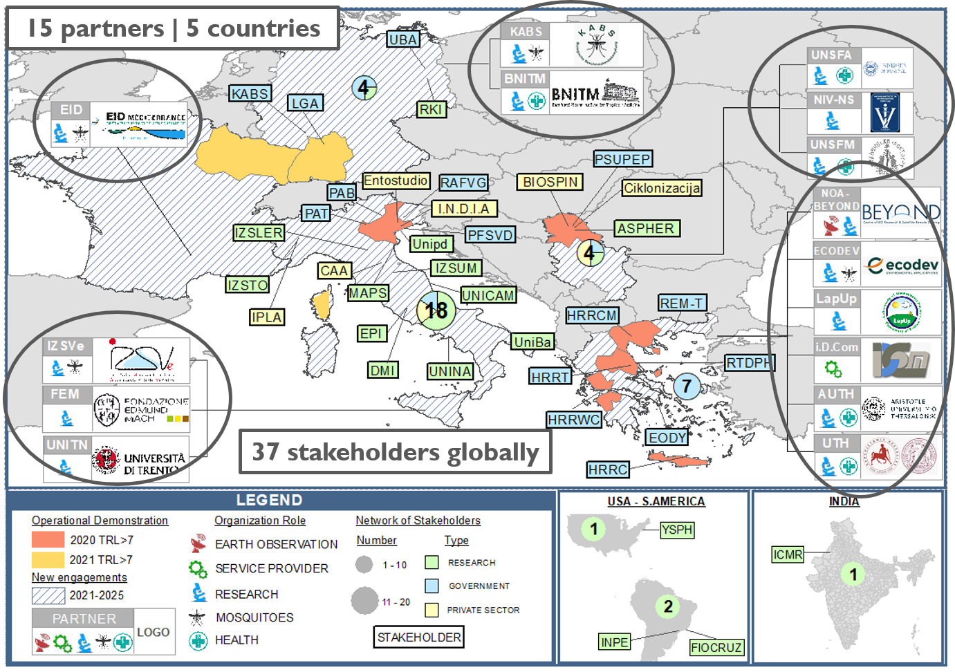
Partners
National Observatory of Athens (NOA) – BEYOND Centre of EO Research & Satellite Remote Sensing Ecodevelopment S.A University of Patras – Physics Department - Laboratory of Atmospheric Physics (LapUP) Dimitrios Vallianatos (IDCOM) Aristotle University of Thessaloniki University of Thessaly, Medical School. Laboratory of Hygiene and Epidemiology
Istituto Zooprofilattico Sperimentale delle Venezie (IZSVe) Edmund Mach Foundation University of Trento |
University of "Novi Sad", Faculty of Agriculture, Laboratory for Medical and Veterinary Entomology Scientific Veterinary Institute "Novi Sad" University of Novi Sad, Faculty of Medicine
German Mosquito Control Association (KABS) Bernhard Nocht Institute for Tropical Medicine
EID Méditerranée |
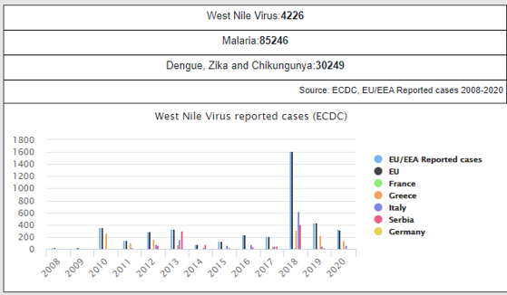
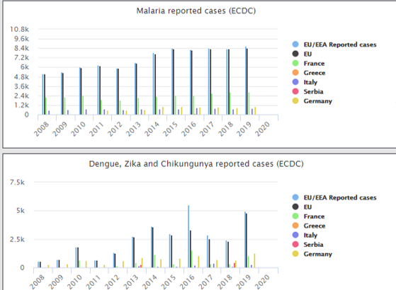
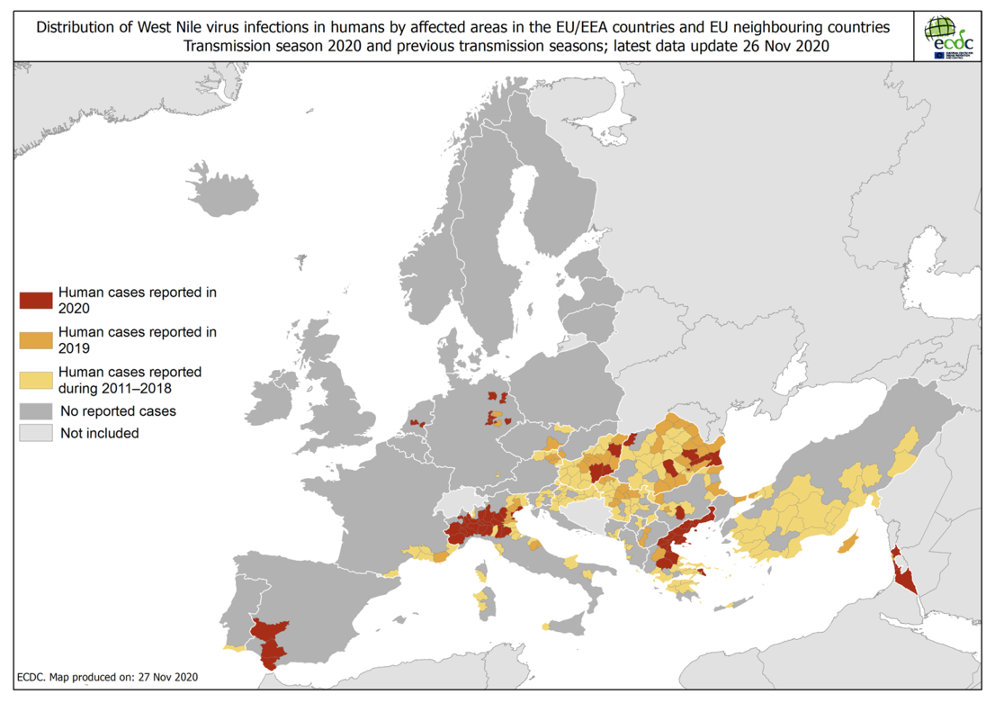
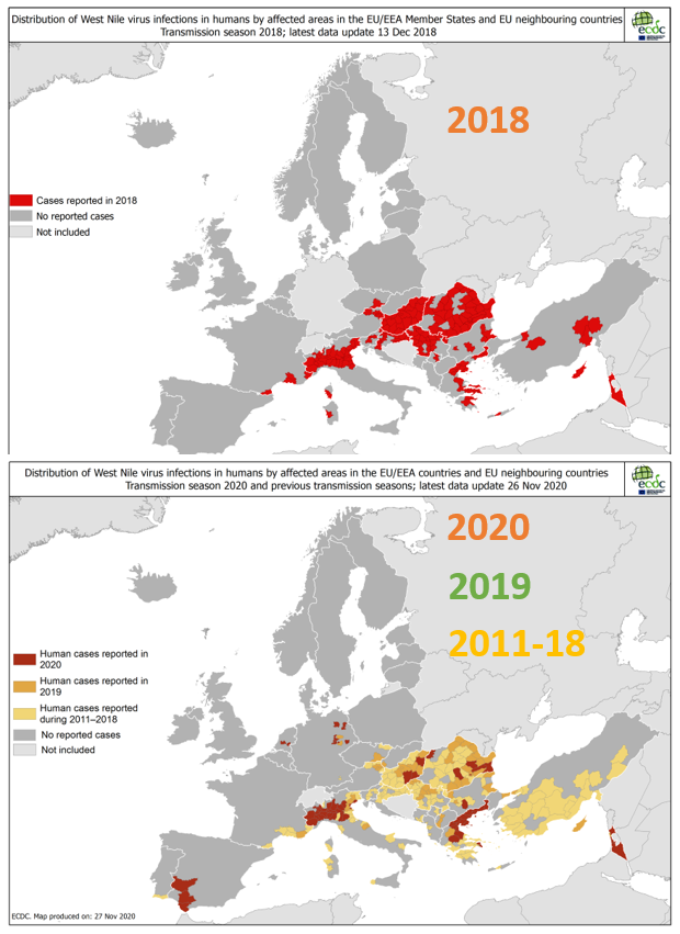
West Nile Virus (WNV)
Europe's eyes on Earth
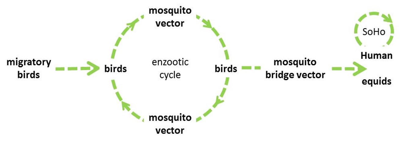
West Nile Virus (WNV)
continental/regional scale
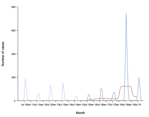
2018: All seasons were warmer than usual, with late spring, summer and autumn all seeing temperatures more than 1 ℃ above average |
|
West Nile Virus (WNV)
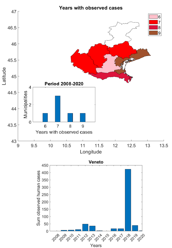
prefecture/province/municipality scale
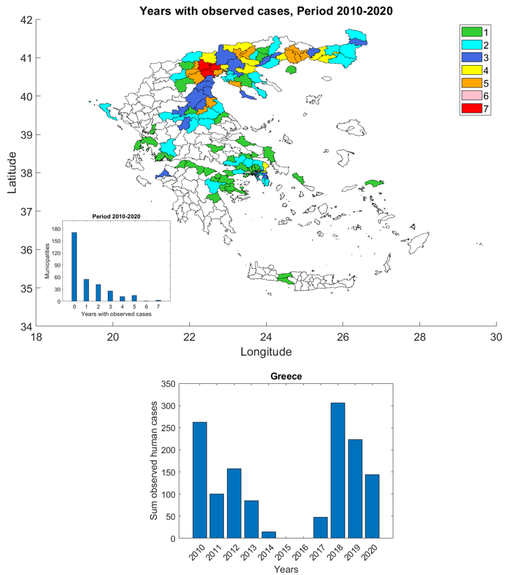
2014-16: A minimum occurs after ~5y cycle. |
|
West Nile Virus (WNV) dynamics
the EYWA approach
|
Mesoscale monthly to seasonal
Microscale weekly to monthly |
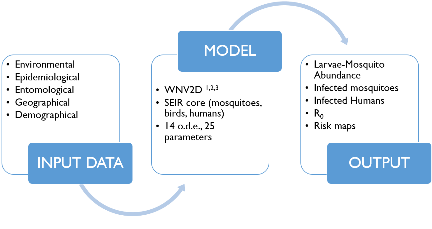
Dynamical core of the EYWA system: the MIMESIS model
MIMESIS: spatial dynaMIcal Model for wESt nIle viruS
Conclusions
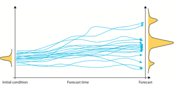
- Quantitative early warning assessments (t~months) of the spatial and temporal variability of WNV circulation in mosquitoes, birds and humans is a major challenge and requires a causative attribution.
- The MIMESIS model, developed at the LapUP, operates spatially at the mesoscale and temporally at the monthly to seasonal scale. It is a dynamic model nested in an ensemble framework to account for the meteorological and epidemiological uncertainty.
- Meteorological uncertainty: ensemble seasonal forecasts.
- Epidemiological uncertainty: relies in an ensemble model developed for this purpose.
- Average detection probability is 72% in GR and 94% in VE, in optimal sense. In forecast mode for 2020, it reached 66-83%.
- The May temperatures are found most critical in shaping the WNV dynamics.
Thank you!

|
www.eo4geo.eu |
@EO4GEOtalks |
|
https://www.atmosphere-upatras.gr/en/ |