Solar Resource and Forecasting at Municipality Level
Co-organized by the University of Patras (in the frame of EO4GEO project) in collaboration with the e-shape project.
Introduction
This webinar aims to designate the potential role of solar energy resource and forecasting in solar farms' efficient planning and operation.
Agenda
- Webinar content/EO4GEO project
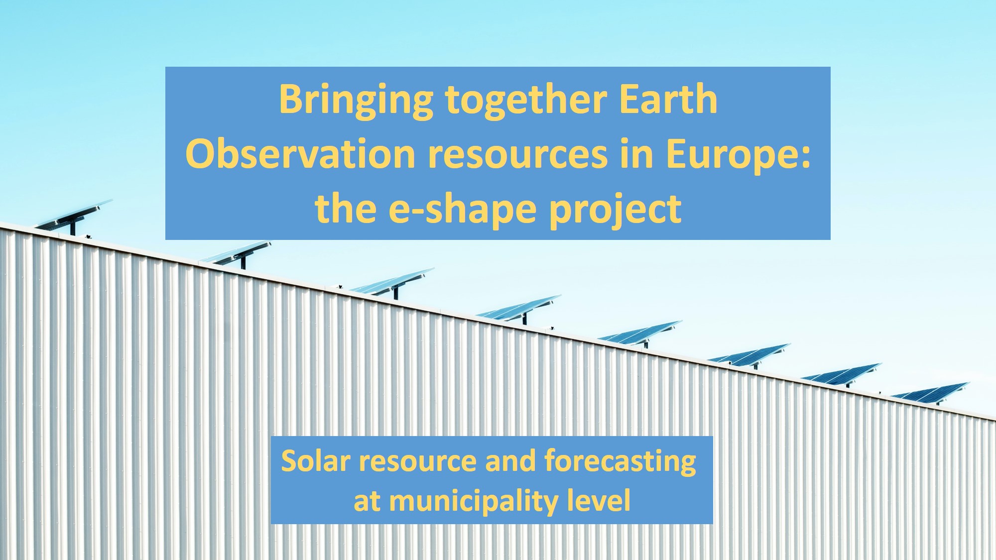
- Bringing together Earth Observation resources in Europe: the e-shape project
- Energy meteorology: Terms and Definitions
- Earth Observation systems for Solar Energy
- Solar energy nowcasting and short-term forecasting
- Use of satellite data to assess and forecast solar energy potential in cities: from
solar cadaster to PV variability at urban scale
Learning outcomes
- Learn the concepts of Energy Meteorology and discuss what it offers to the solar sector
- Recognize the main atmospheric and solar-related parameters that contribute to the
efficient use of PV and CSP systems
- Learn the basic principles of solar forecasting
- Discuss about Earth Observations (EO) for solar nowcasting and forecasting
- Identify the use of solar energy tools for urban-scale applications
- Learn about PV nowcasting and short-term forecasting in urban scale
Laboratory of Atmospheric Physics
 |
Research Axes
|
The Space/Geospatial Sector Skills Alliance
Towards an innovative strategy for skills development and capacity building in the space geo-information sector supporting Copernicus User Uptake

The EO4GEO project
- Duration: 4 years from January the 1st, 2018
- Budget: 3,87 million €
- Partnership: 25 Partners + 30+ Associated Partners (from 16 EU Countries) from
Academia, Companies and networks
- Coordinators: GISIG (General), KU Leuven (Scientific & Technological), PLUS
(Education & Training), Climate-KIC (Exploitation)
The VISION
To foster the growth of the European Earth Observation / Geographic Information (EO/GI) sector ensuring a workforce with the right skills, in the right place, at the right time.
The MISSION
To ensure the strategic cooperation among stakeholders on skills development in the EO/GI sector.
EO4GEO IS MUCH MORE
- A series of pre-defined curiculla in support of Copernicus
- A portfolio of training modules directly usable in the context of Copernicus and
other relevant prograns
- A series of training actions (webinars, academic courses, etc.) in the three
sub-sectors - integrated applications, smart cities and climate change
- A mobility program to promote internships and on-the-job training
- A Long-term Action plan to sustain the proposed solutions

|
www.eo4geo.eu |
@EO4GEOtalks |
Let's start from the basics...
What is Energy Meteorology?
- Energy Meteorology is in the interface of renewable energy and atmospheric physics
- Atmospheric physics is needed for the assessment and forecasting of the power output from solar and wind energy systems as well as for the planning, monitoring, and efficient operation of these systems.
What energy meteorology offers to the solar sector?
- Higher penetration in the energy mix and efficient grid integration
- Efficient use of large-scale applications
Most Important
International and consensus collaboration

Earth Observation systems for Solar Energy
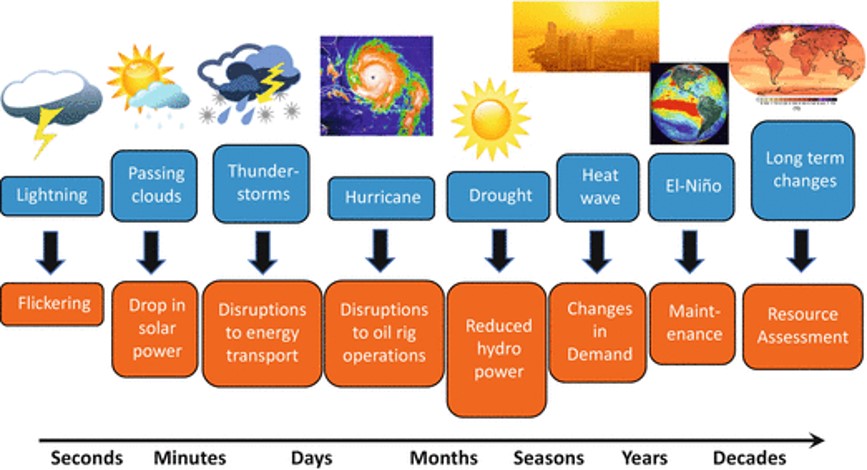
Different space and time scales for solar resource assessment
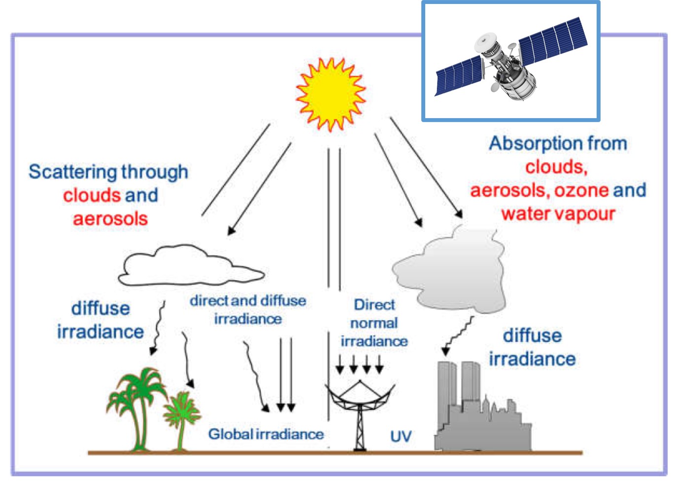
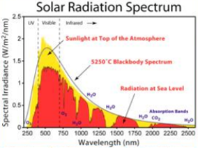
Direct, Diffuse and Global Irradiance
|
GHI = BNI + DNI×cos(θ)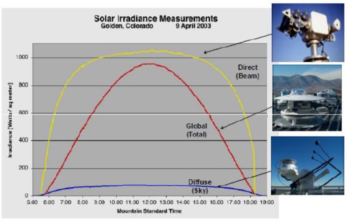
|
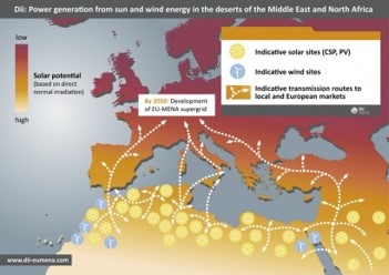
Concentrating solar power and photovoltaics

The ground-truth
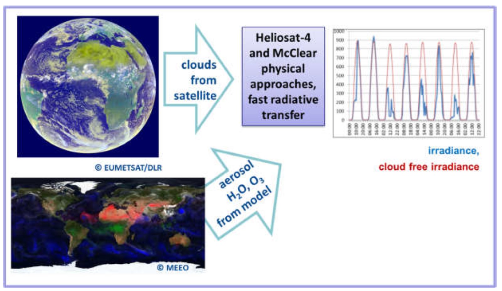
The principle of radiative transfer and the satellite-derived solution
The principle of radiative transfer and the satellite-derived solution
CAMS Radiation service (CRS)
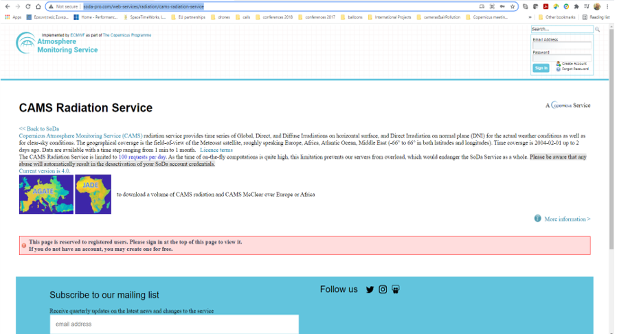
You can select site, start/end date and time step and download your data
The challenge

|
How we can apply Earth Observation data to meet the demands for typical solar energy applications? What are the benefits and drawbacks of such an approach? |
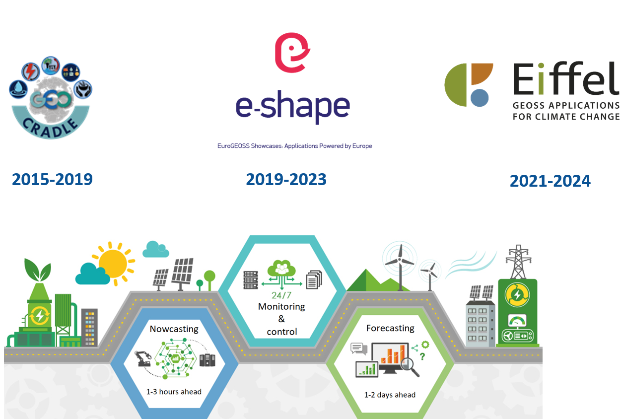
The e-shape project
e-shape - EuroGEO Showcases Applications Powered by Europe
- European contribution to GEO establishing EuroGEO
- 15M€, 69 partners, 7 showcases, 37 pilots
- 4 years grant (2019-2023)
- ARMINES (France) coordinator – e-shape.eu

- Promoting users’ uptake of European Earth Observation (EO) resources
- Building on Copernicus and GEOSS through the development of co-design
pilots
- Built on a user-centric approach to deliver economic, social and
policy value to European citizens.
Objectives
- O1: Develop operational EO services with and for users active in key societal
sectors
- O2: Demonstrate the benefits of the EO pilots through the coordinated downstream
exploitation of EO data and the utilization of existing EO resources
- O3: Promote the uptake of pilots at national and international scale, across
vertical markets (private and public) and amongst key user communities
- O4: Enable the long-term sustainability of the numerous pilots, their penetration
in public and private markets and support their upscaling
- O5: Increase uptake by raising awareness on the solutions developed through
tailored and well-targeted communication, dissemination and outreach
activities
e-shape - EuroGEO Showcases Applications Powered by Europe

Solar radiation/energy nowcasting and short-term forecasting
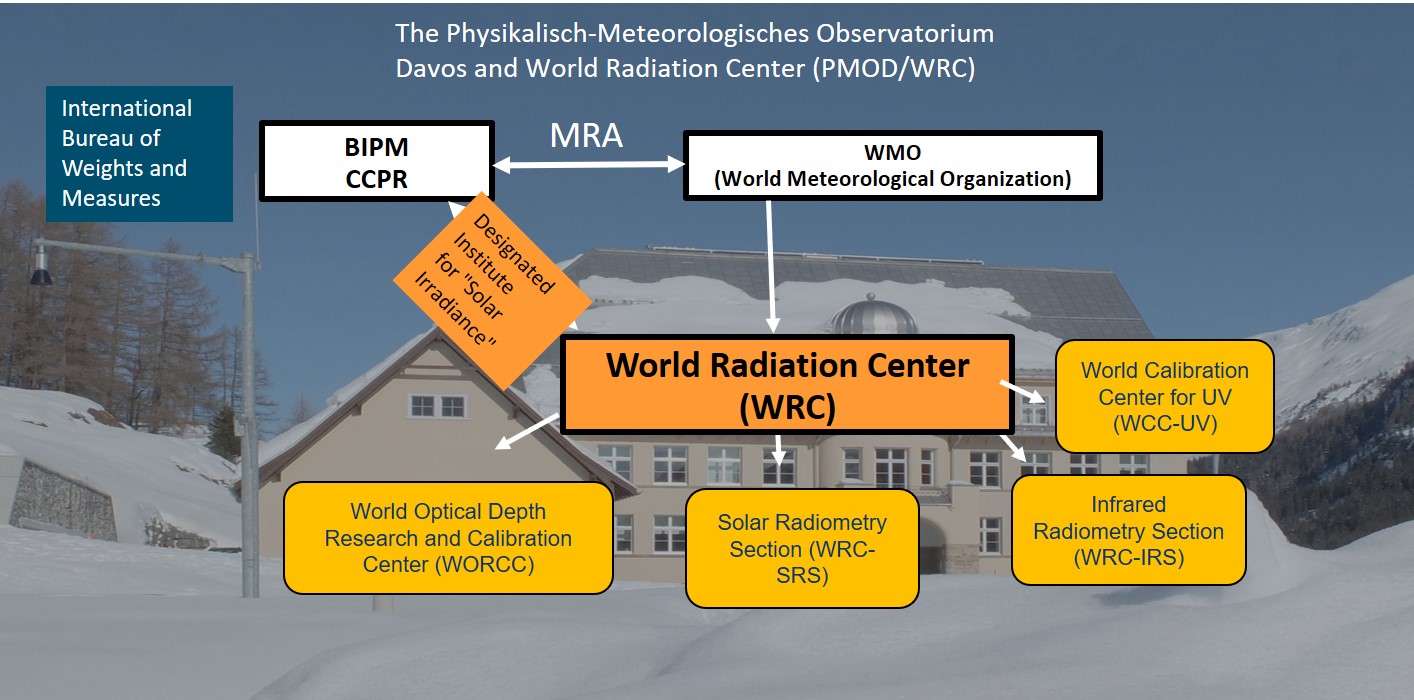
PMOD-WRC
Solar radiation forecasting basics


|
Surface solar radiation is variable spatiotemporaly
|
- Different components (GHI & DNI)
Solar variability affects:
- National and regional electric grid stability
- Solar contribution in the energy mix / (real time demand)
- Planning and management of PV and CSP
- Trading, distribution, storage, optimization
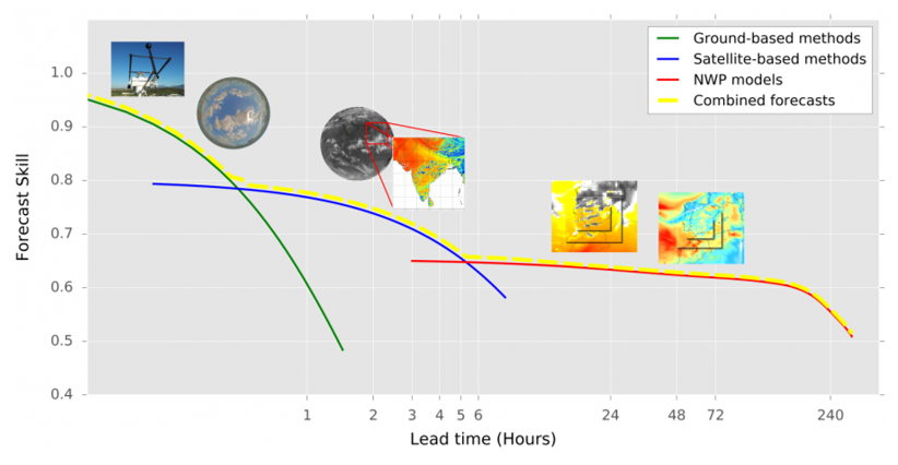
Solar radiation forecasting basics
Forecasting approaches
|
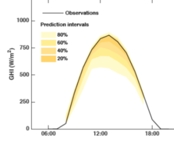
|
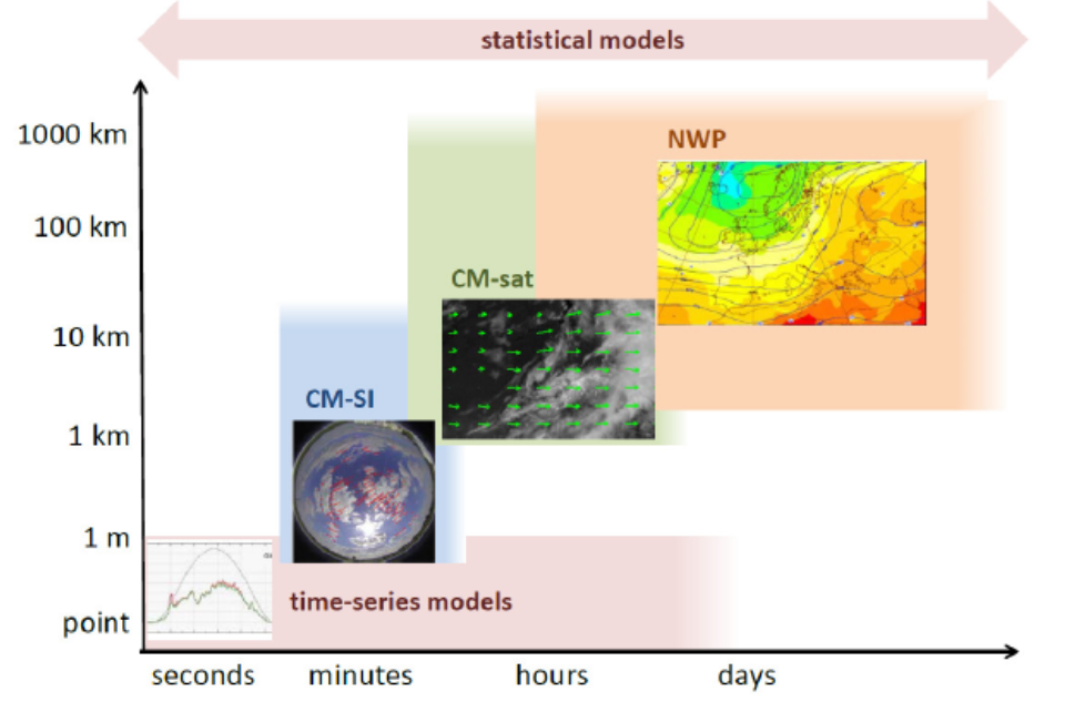
Solar radiation forecasting basics
Forecasting approaches
|
|
Solar radiation/energy forecasting and now-casting
EO and solar nowcasting/The Sense System
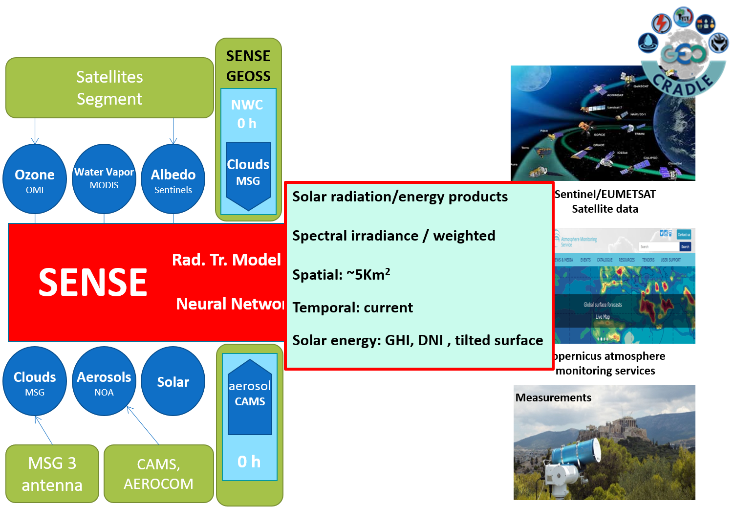
EO and solar Nowcasting/Clouds
EO and solar Nowcasting
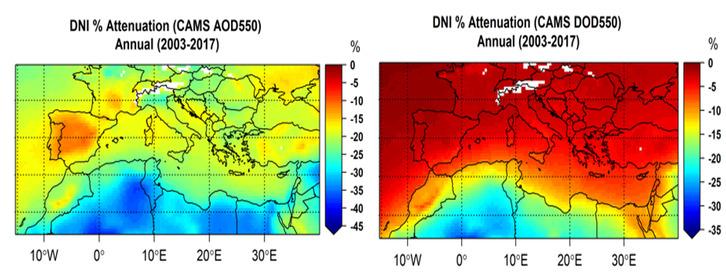
Aerosols
Aerosols
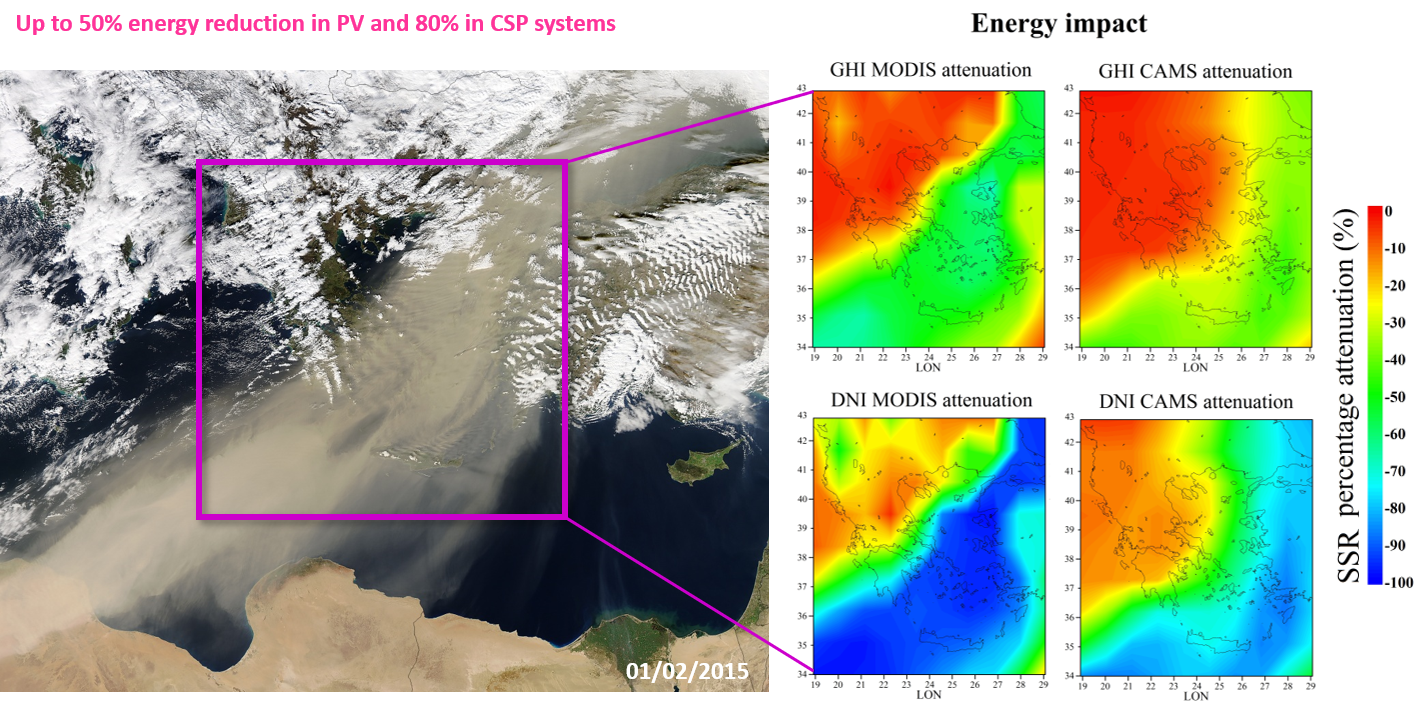
Aerosols
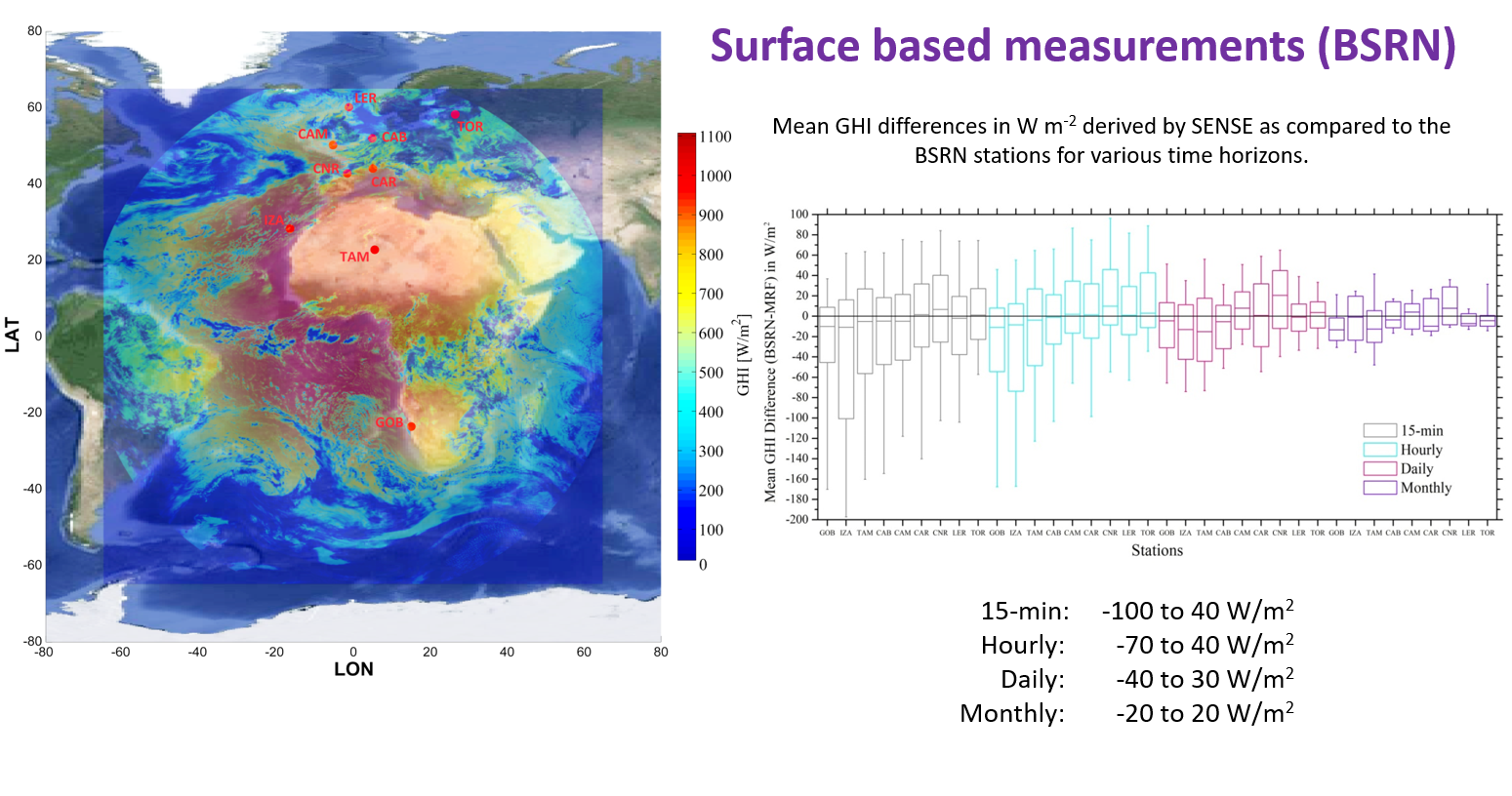
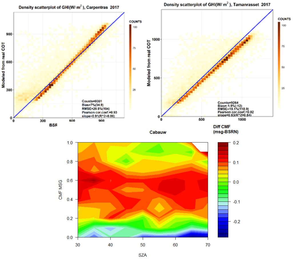
Sense validation
nextSense Solar Forecasting
E-Shape: nextSENSE: introduction of Cloud motion vector forecasting
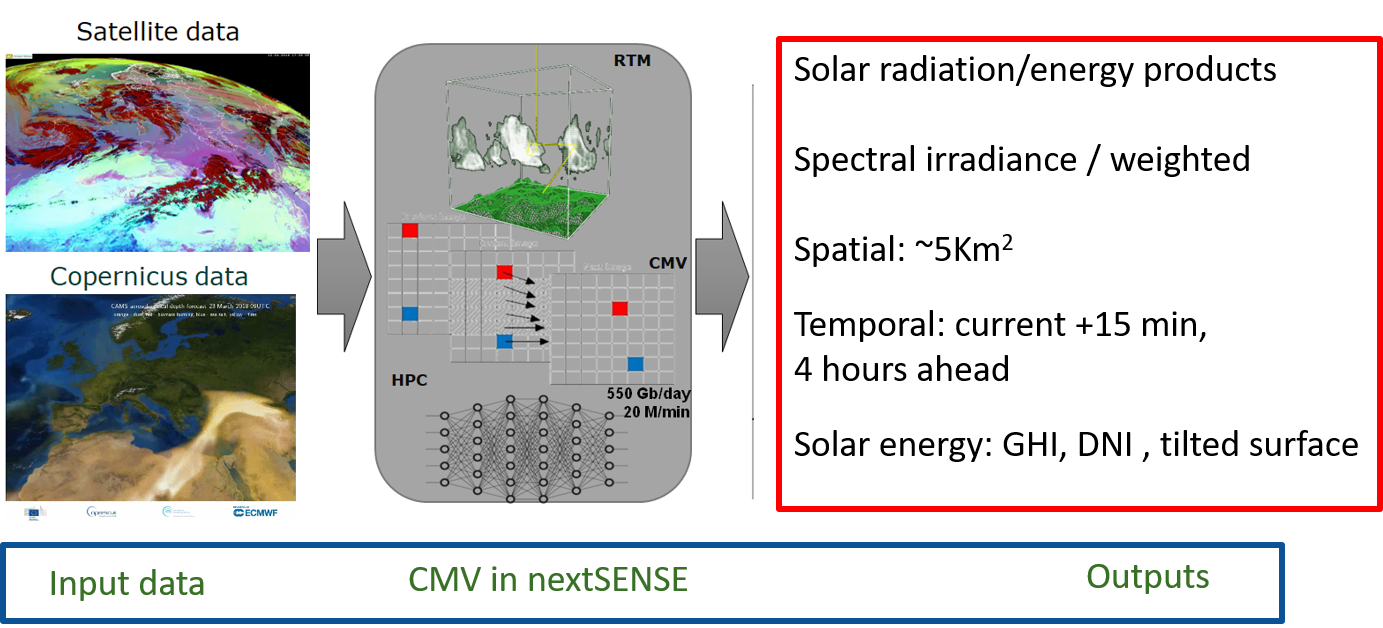
Cloud Motion Vectors
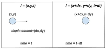
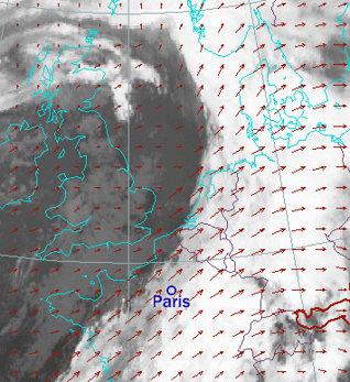
|
|
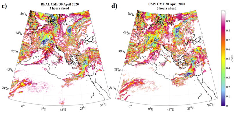
nextSense Solar Forecasting validation
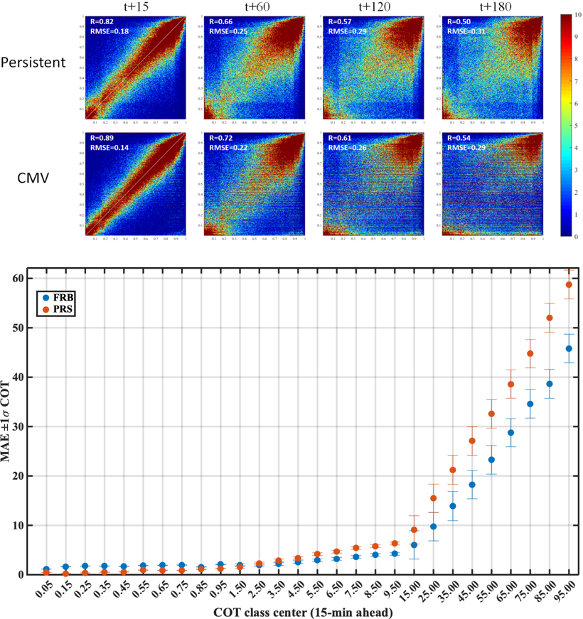
nextSense Solar Forecasting validation
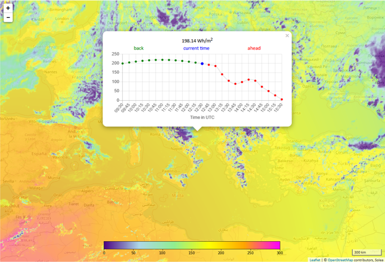
nextSense - demonstration
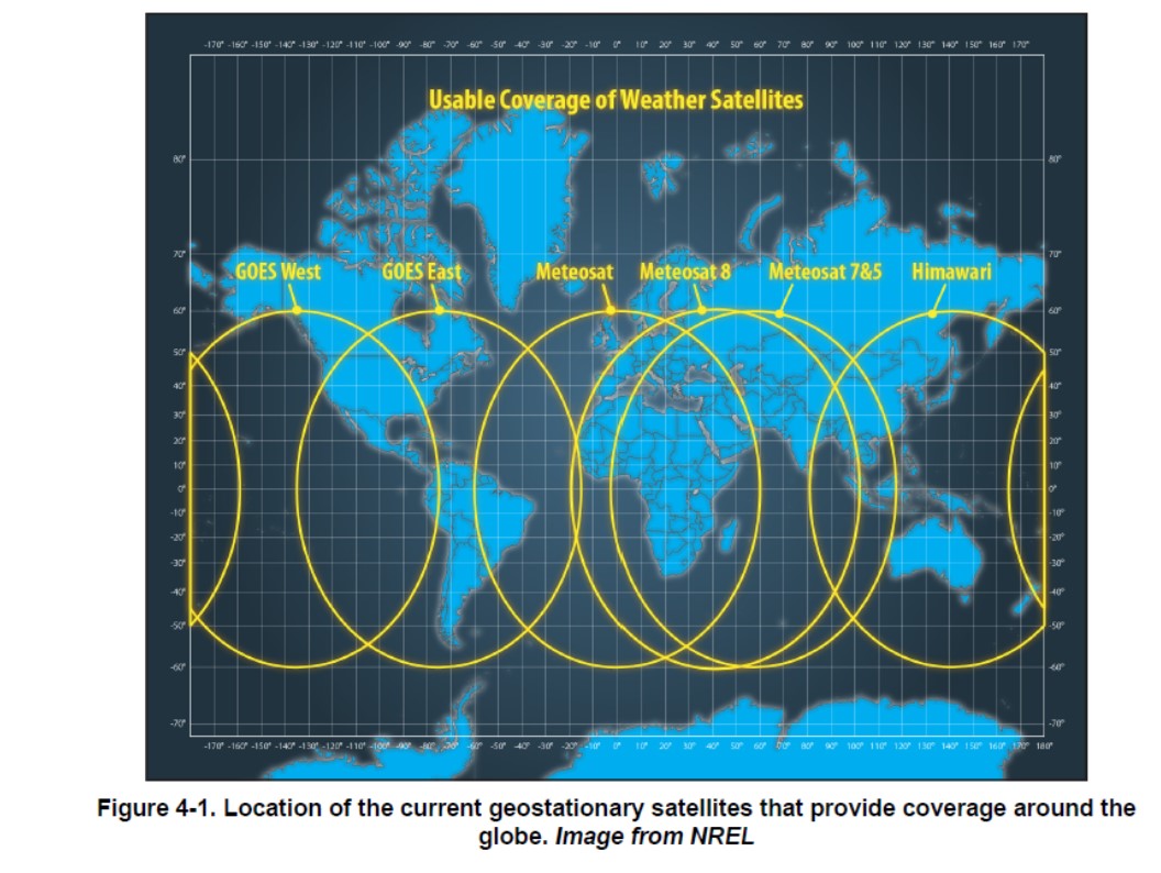
EO and solar forecasting - Global
Example nextSense approach for India
INSAT 3D satellite full domain
|
INSAT 3D satellite use for India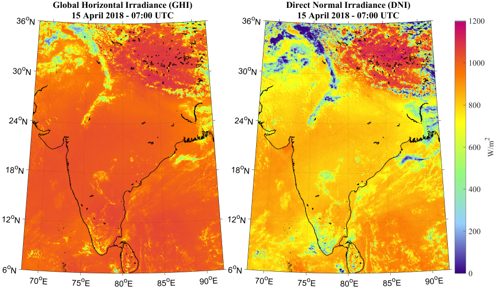
|
Users and co-design aspect
|
|
Remarks
Solar power forecasting is essential for cost-effective energy system integration of solar
energy. Applications: specific requirements with respect to forecast horizon and spatiotemporal
resolution.
Forecasting solar irradiance should be evaluated in the context of strategies for the system
integration of solar power, which aim to provide the necessary power to cover demand at any
time.
Reliable short-term irradiance forecasts can be derived from EO based data using cloud
motion-based methodologies.
Forecast evaluations are important. Hybrid approaches on used methodologies could be beneficial
Choice of a forecast method depends on:
- User needs
- Measurement data and model availability
- Spatiotemporal aspects
- Evaluation – uncertainty of method
- Technical aspects
Use of satellite data to assess and forecast solar energy potential in cities: from solar cadaster to PV variability at urban scale
Solar Cadaster: high resolution (metric) urban solar mapping

Photovoltaic (PV) systems (rooftop, parking shades,
etc.) in urban areas are very interesting
- Low cost since the price of PV modules are constantly and dramatically decreasing
- No emission of pollutants nor GHGs during their exploitation
- Production of electricity where this electricity is consumed
- Added value to unused urban roofs/parking shades (e.g. commercial centre)
- Positive impact on Urban Heat Island
Solar Cadasters enable to:
- Analyse the solar potential of roofs/shades over a city w.r.t. the local electricity
consumption
- Help public or private decision-makers and investors
Solar Cadaster from In Sun We Trust
In Sun We Trust is providing free, accurate and easy-to-use tool
for the general public to assess solar potential of rooftop PV systems with the
support of:
|

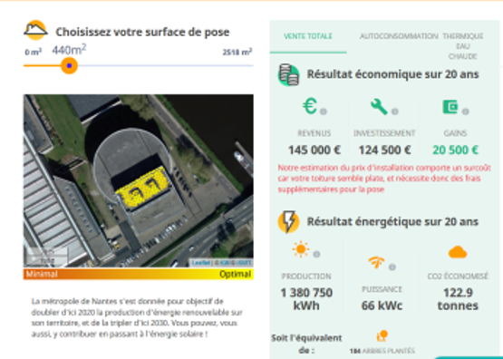
|
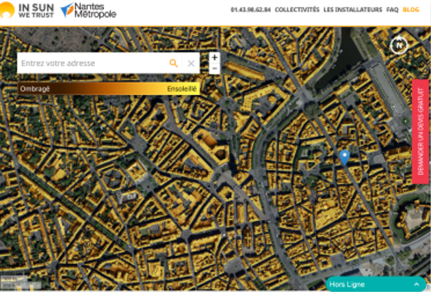
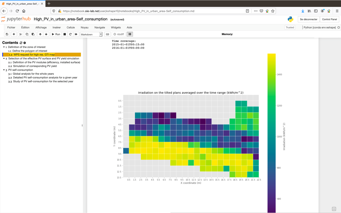
From Solar Cadaster to urban-scale solar variability
Static yearly irradiation on tilted plans (1-m res.)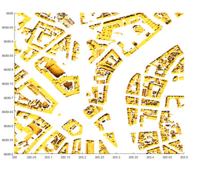
|
Near on-the-fly computation of intra-day irradiation on tilted plans (1-m res.)
|
Renewable Energy Showcase - Pilot #2: High PV penetration in urban area
- Objective: develop GIS-tools dedicated to high photovoltaic penetration at
urban scale, providing EO based information about urban energy system
modeling, electric energy demand profiles and accurate electric production of fleet of
PV rooftop systems
- Expected user community: Urban planners, grid operators, aggregator for energy
trading, researchers in Energy and Urban planning and citizens (self-consumption)>
- Two parts of the pilot:
- Part 1: PV variability at urban scale (pilot in Nantes)
- Part 2: EO-data for PV integration in the urban energy system (pilot in Oldenburg)
- Supporting infrastructure: DIAS WEkEO, Urban TEP
- Partners:
![partners pilot 2]()
- Part 1: PV variability at urban scale (pilot in Nantes)
- Part 2: EO-data for PV integration in the urban energy system (pilot in Oldenburg)

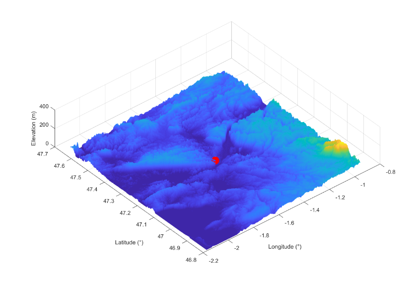
EO data
|
|
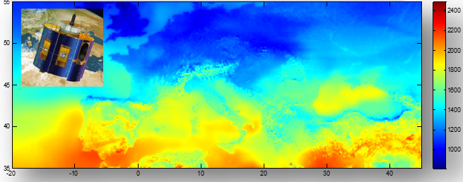
The EO data for clear-sky irradiance modeling
Clouds are not the only source of solar variability. The irradiance for clear-sky (cloud-free) condition from McClear (CAMS), integrating aerosols, water vapor depending on the Sun topocentric position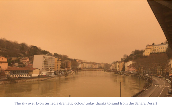
|

|
The EO data for clear-sky irradiance modeling
Example with in-situ measurements under clear-sky in Shanghai
Clear-Sky GHI with Climatology Monthly Linke Turbidity (ESRA Model)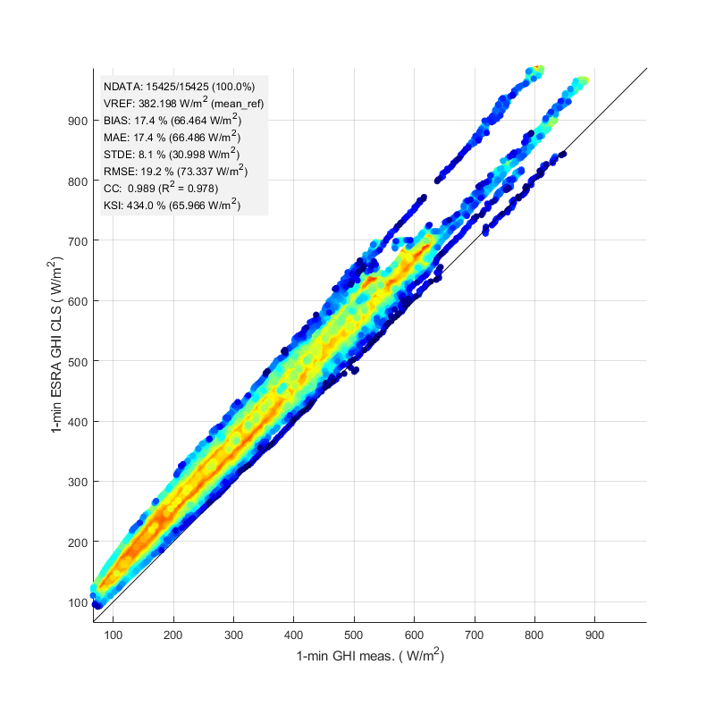
|
Clear-Sky GHI from McClear (Aerosol + WV from CAMS)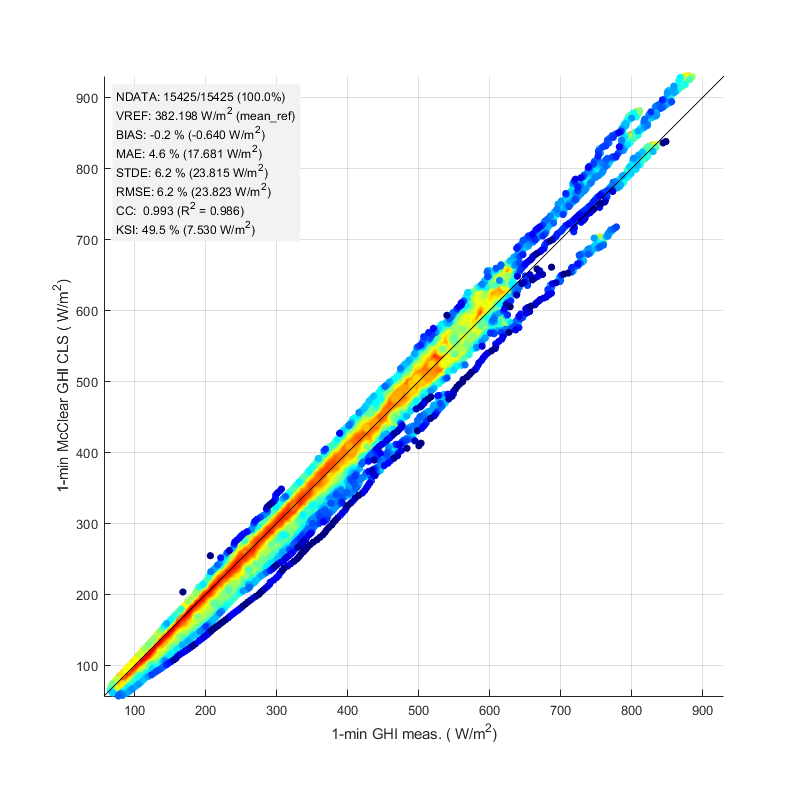
|
The EO data for all-sky irradiance estimation
Satellite-based all-sky solar data HelioClim-3/CAMS Rad (3 km, 15 min, 2004-,
15+ years)
|
|
 |
|
At least one year of in-situ pyranometric measurements for local calibration |
|
Data and Information Access Services (DIAS)
- DIAS WEkEO
![DIAS]()
- Providing cloud processing requested on-the-fly through asynchronous OGC Web
Processing Services (WPS)
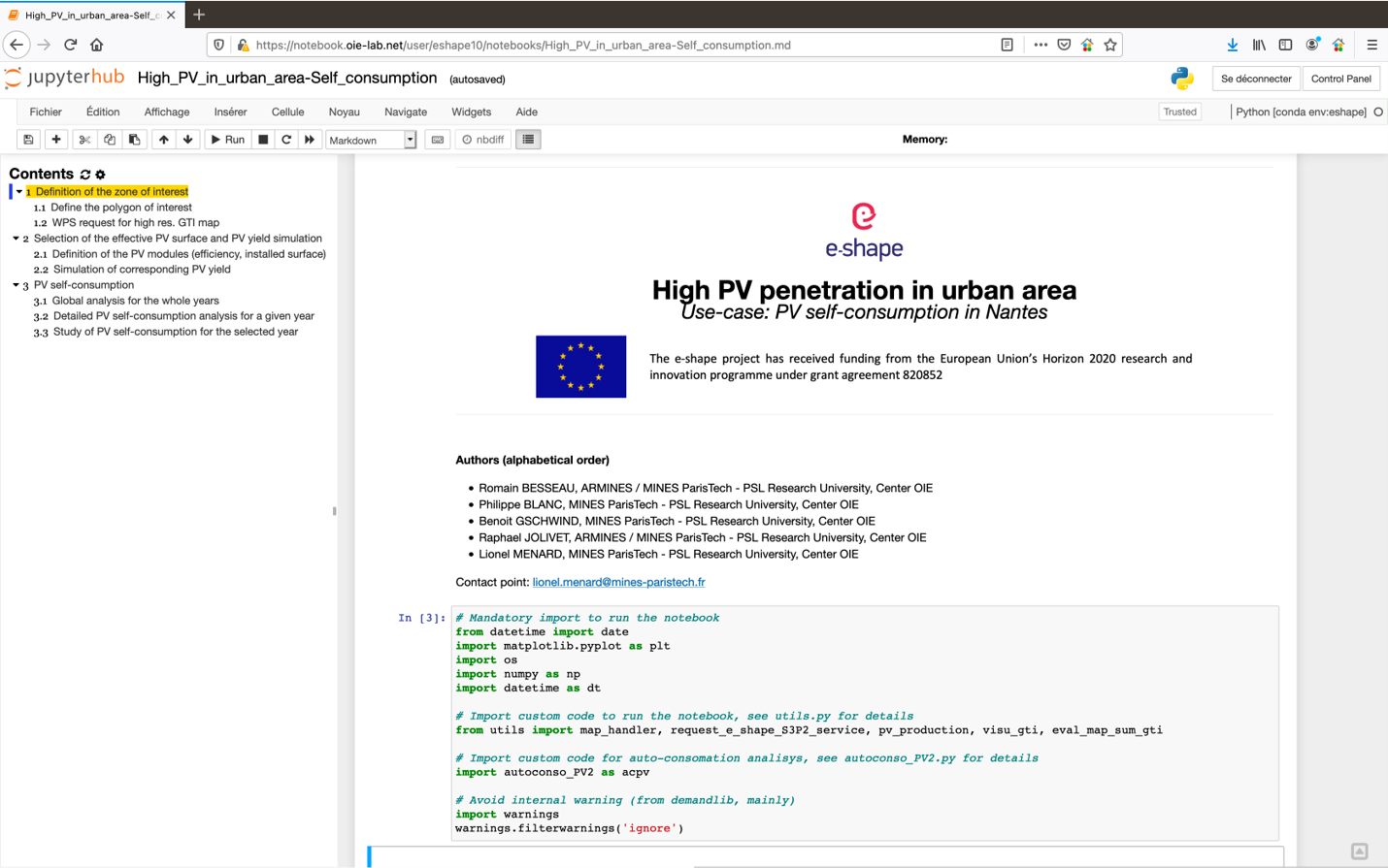
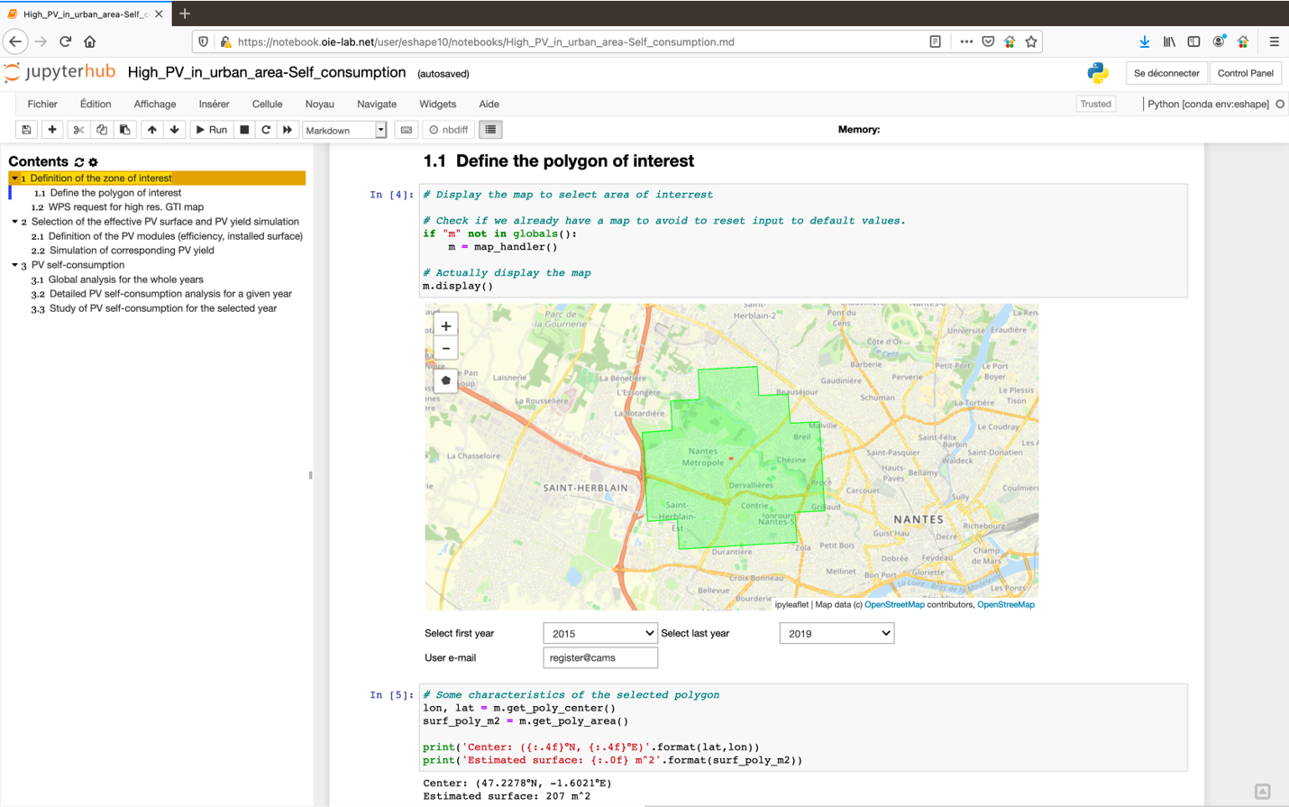
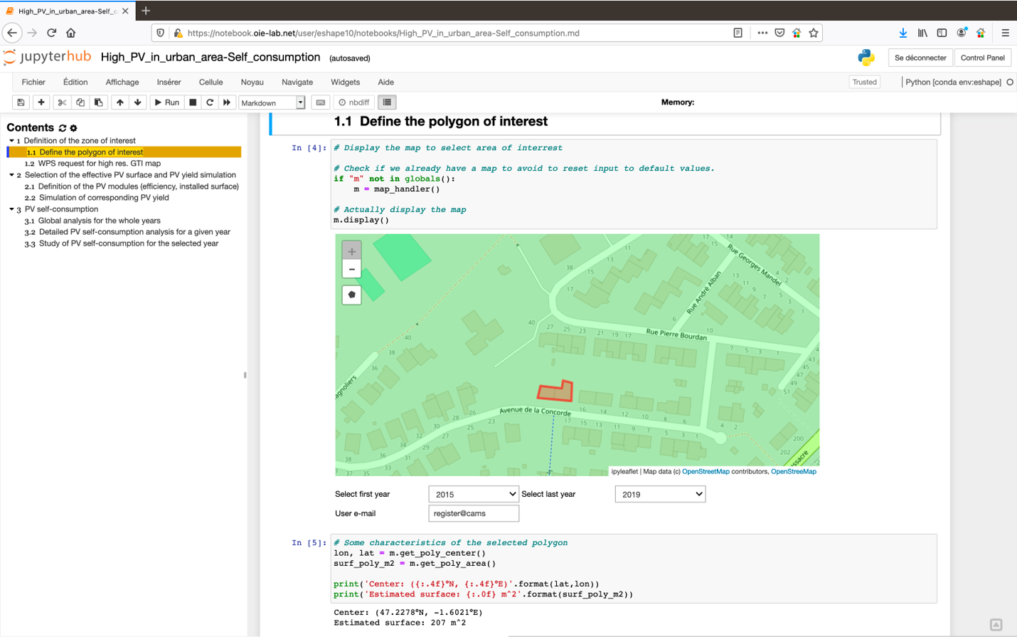
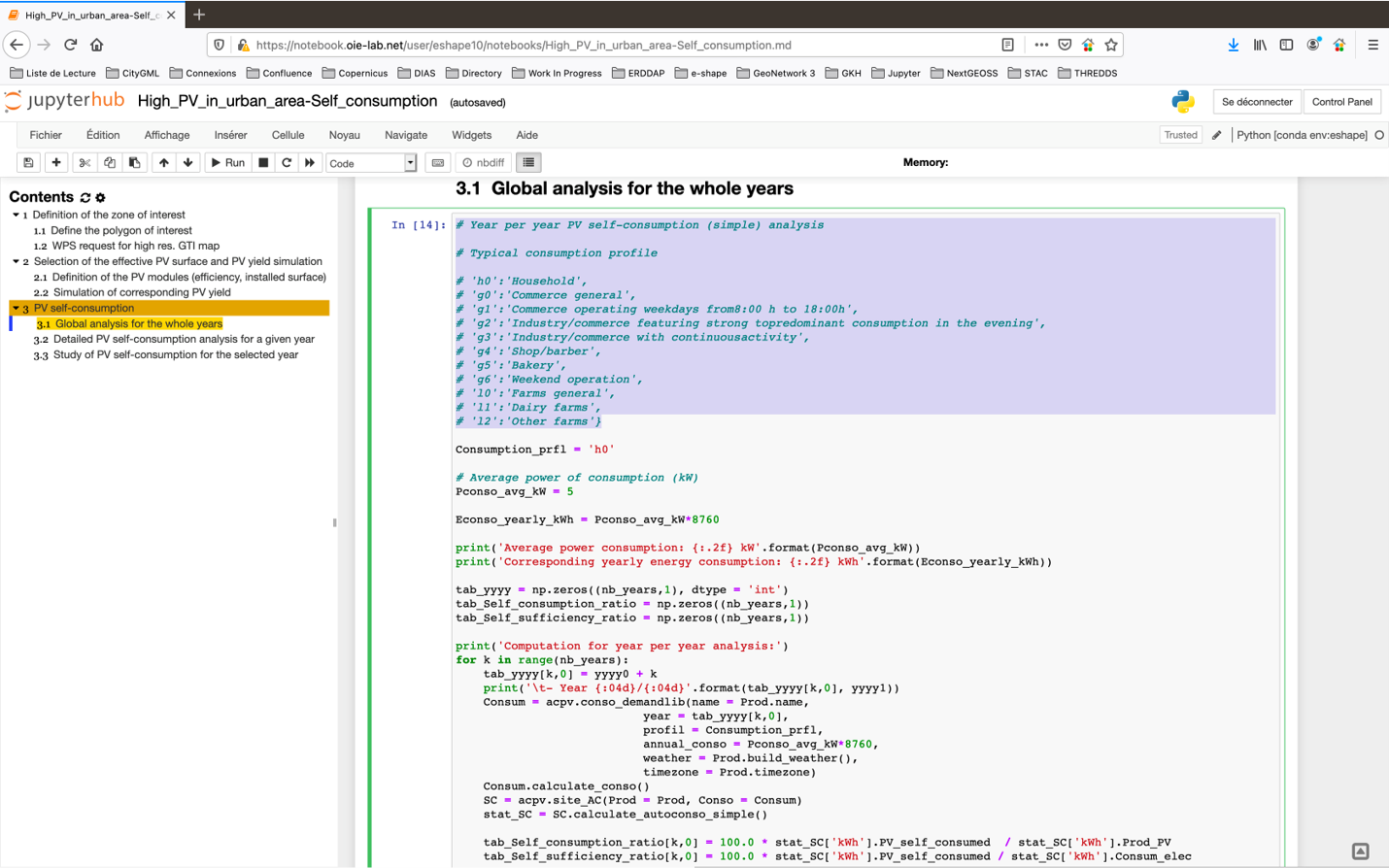
- Hosting a Jupyter Hub with Jupyter Notebooks exemplifying in Python
different use-cases with:
- GIS-like interface
- WPS asynchronous requests
- Output data exploitation and representation
![jupyter]()

- GIS-like interface
- WPS asynchronous requests
- Output data exploitation and representation

Overview of the pilot organized around a “core” service
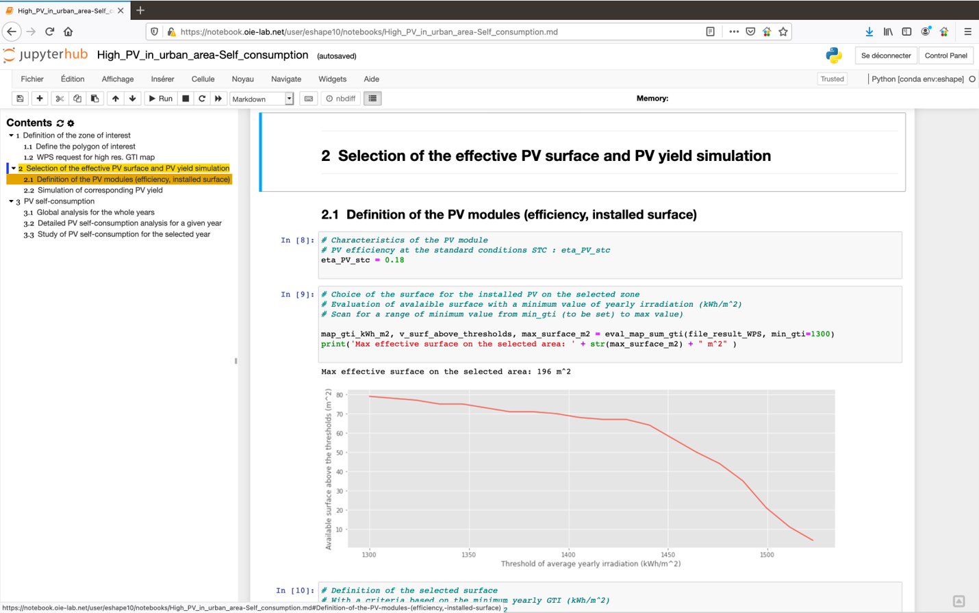
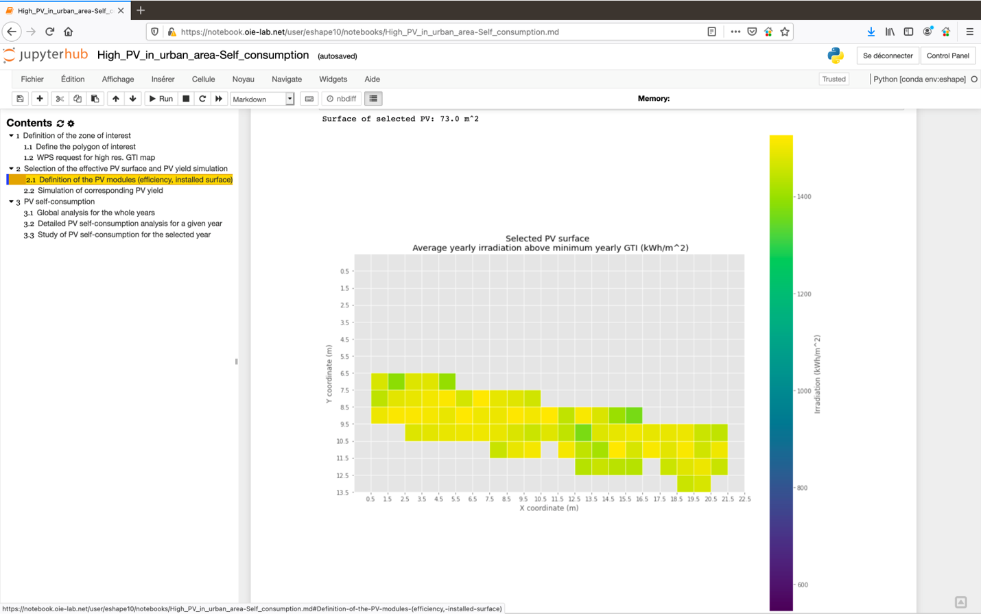
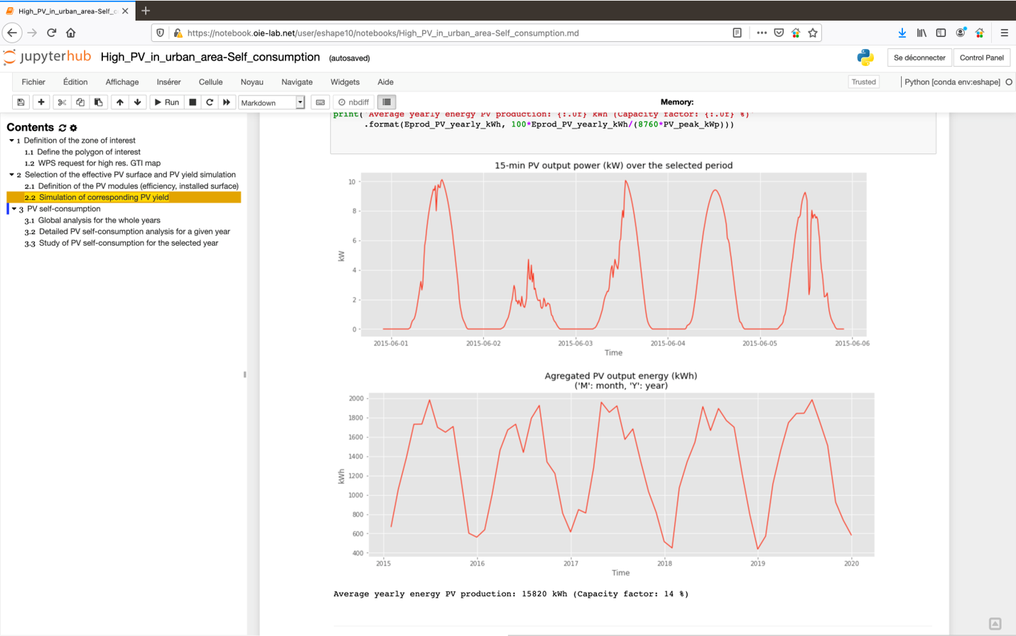
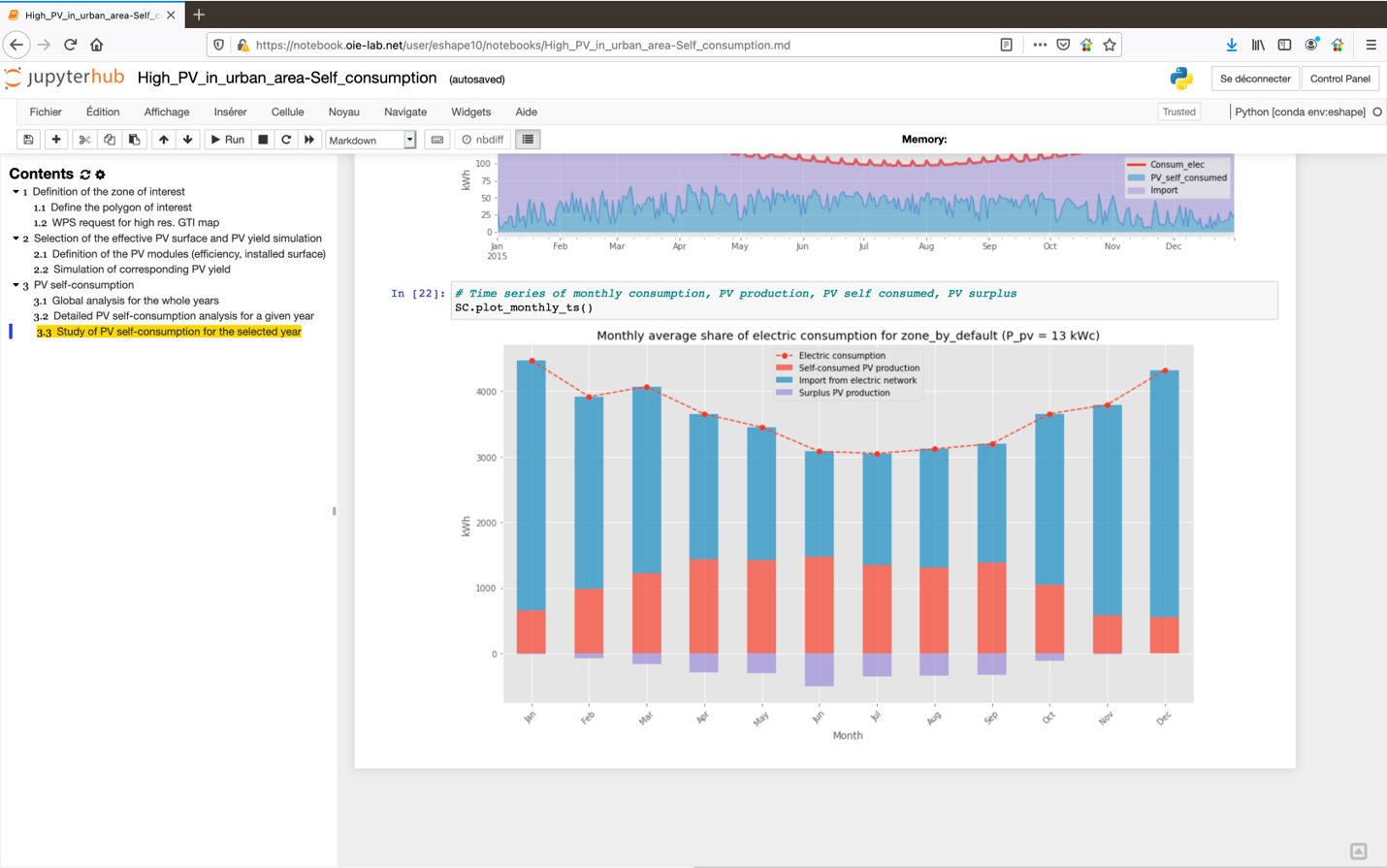
Available pilot on Jupyter Notebook
Available pilot on Jupyter Notebook
Available pilot on Jupyter Notebook
Available pilot on Jupyter Notebook
Available pilot on Jupyter Notebook
Available pilot on Jupyter Notebook
Available pilot on Jupyter Notebook
Available pilot on Jupyter Notebook
Available pilot on Jupyter Notebook
Available pilot on Jupyter Notebook
Hands-on session recording - Youtube:
https://www.youtube.com/watch?v=Sj9eMoLFi0g
To get an account to test the pilot:
lionel.menard@mines-paristech.fr
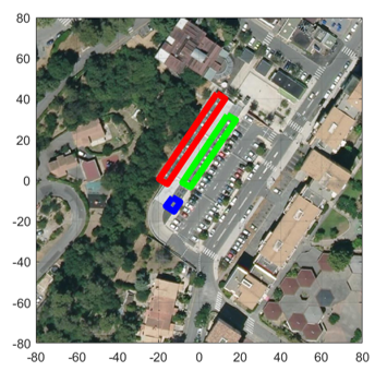
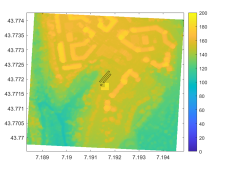
Local urban planning & PV
Study of a PV parking shades (100 kWp) impacted by a “new” building
|
|
Historical analysis of PV variability (case #2)
Usage: Simulated PV injection in different source points of the electric grid for different scenarios of PV penetration (for DSO, e.g. ENEDIS)
Example:urban area of of 1.5 km x 1.5
km 20 % PV penetration:
Nameplate PV power injected in the source points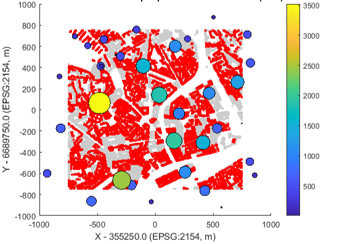
|
Temporal evolution of instantaneous PV power potentially injected within a day
|
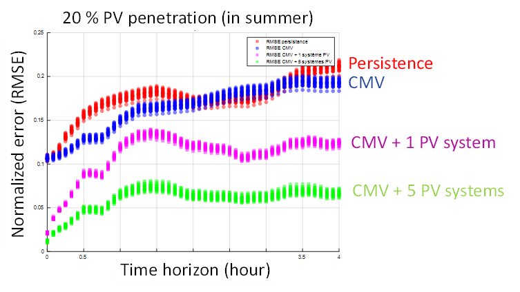
PV nowcasting & short-term forecasting (case #3)
Usage: Energy trading with portfolio of PV rooftop
systems(e.g. Urban Solar Energy ?)
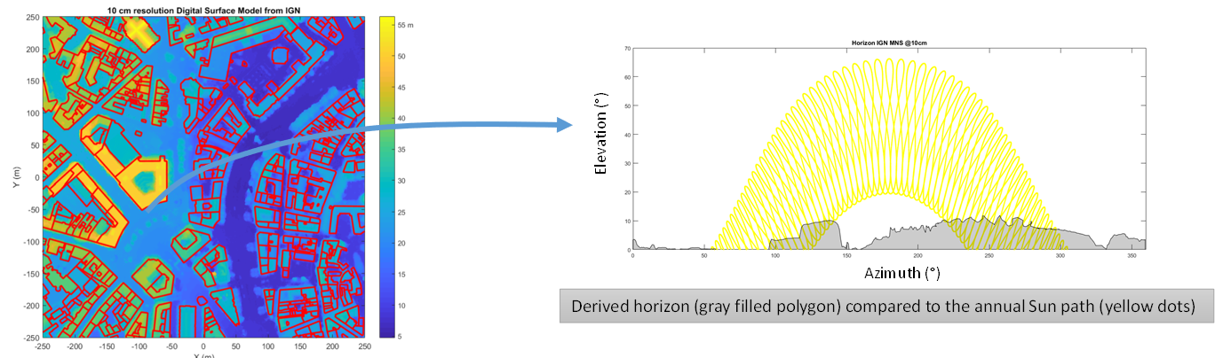
Use of Cloud Motion Vector (CMV) from two consecutive satellite images:
- CAMS aerosol / water vapor forecasting (CAMS McClear)
- 3D shadowing effects from DSM
Potential use of some PV yield monitoring (in-situ) in the real time loop of forecasting
correction
|
|
PV nowcasting & short-term forecasting (case #3)
Further information...
Thank you!
|
|
www.eo4geo.eu |
@EO4GEOtalks |

|
https://www.atmosphere-upatras.gr/en/ |