Copernicus Service - Land
(EO4GEO - Faculty of Geodesy University of Zagreb)What is Copernicus?
-
Copernicus is an EU programme aimed at developing European information services based on satellite Earth Observation andin situ (non space) data.
-
Copernicus is implemented by the European Commission (EC) with the support from the European Space Agency (ESA) for the Space component and the European Environment Agency (EEA) for the in situ component (https://emergency.copernicus.eu/mapping/ems/what-copernicus).
The objective of Copernicus
-
To monitor and forecast the state of the environment on land, sea and in the atmosphere, in order to support climate change mitigation and adaptation strategies, the efficient management of emergency situations and the improvement of the security of every citizen (https://emergency.copernicus.eu/mapping/ems/what-copernicus ).
-
It combines satellite observation data with data from sensor networks on the Earth’s surface to build a comprehensive picture of our planet and its environment (https://www.eea.europa.eu/about-us/who/copernicus-1 ).
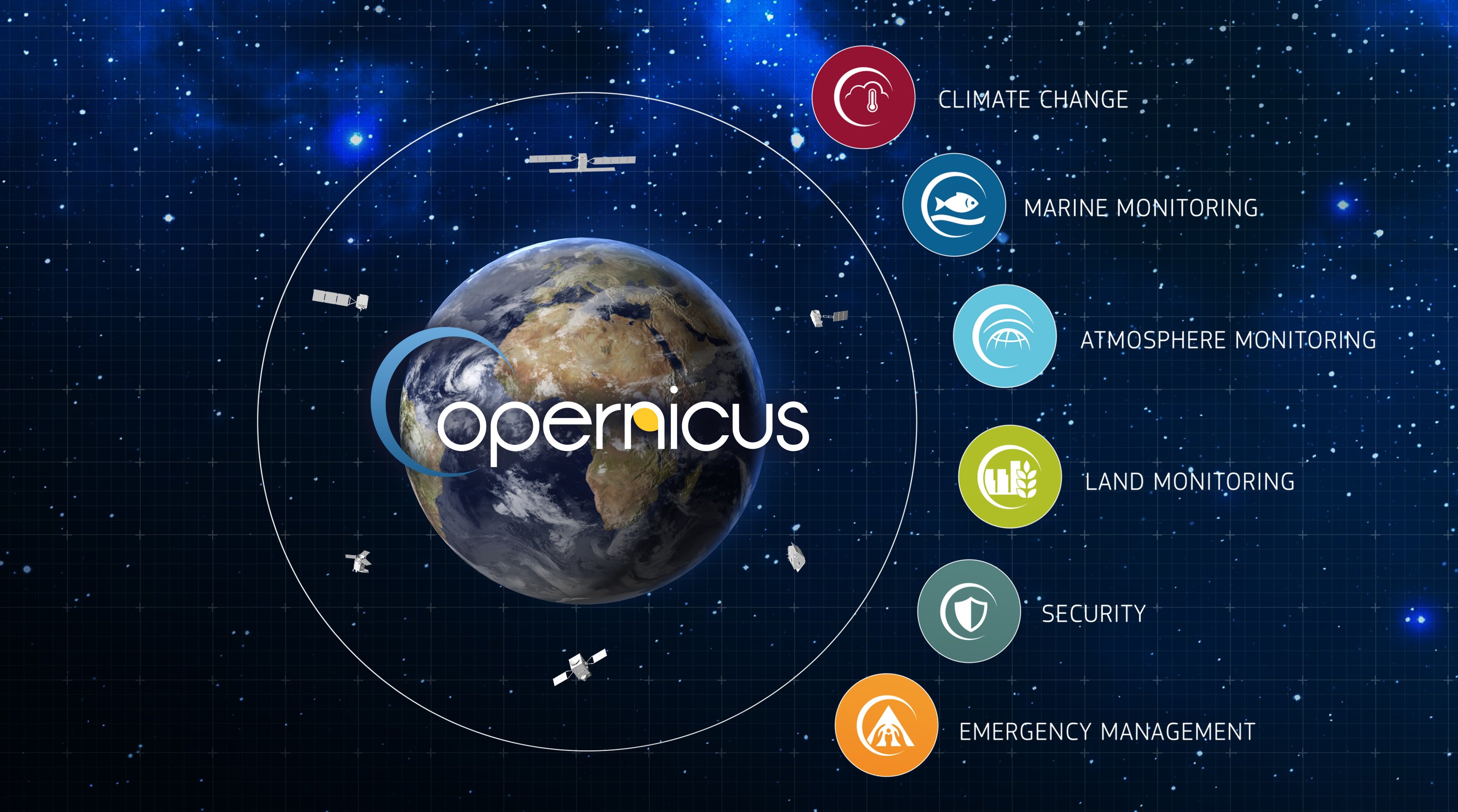
The Components of Copernicus
- Three components make up Copernicus: Space, Services and In Situ.
- The Services Component is made up of six thematic areas: land, marine, atmosphere, climate change, emergency management and security (https://www.eea.europa.eu/about-us/who/copernicus-1).
https://https://twitter.com/CopernicusEU/status/1037690292193947648/photo/1
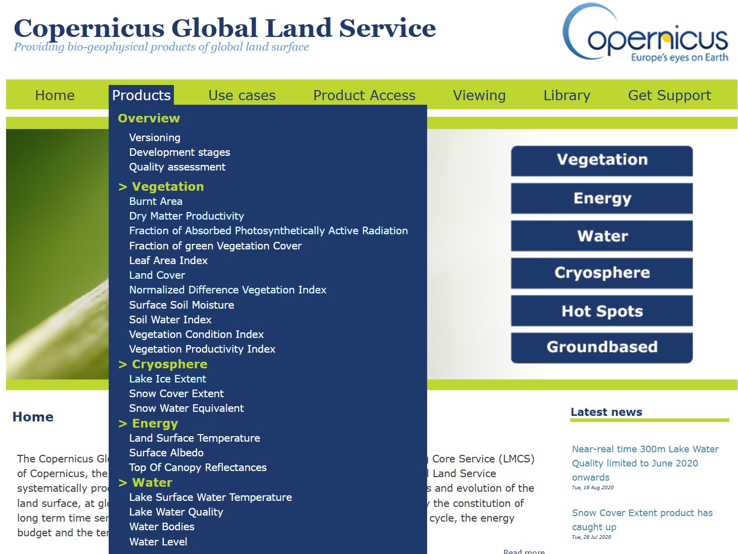
Copernicus Land Monitoring Service (CLMS)
- CLMS provides geographical information on land cover and its changes, land use, vegetation state, water cycle and earth surface energy variables to a broad range of users in Europe and across the World.
- It supports applications in a variety of domains such as spatial and urban planning, forest management, water management, agriculture, food,...
- CLMS is jointly implemented by the European Environment Agency (EEA) and the European Commission DG Joint Research Centre (JRC).
- The Land Monitoring Service has been in operational use since 2012 (https://www.copernicus.eu/en/services/land ).
CLMS Main Components
- Systematic biophysical monitoring
- Land cover and land use mapping
- Thematic hotspot mapping
- Reference data
- Ground motion service
Posible Application
- Spatial and urban planning
- Forest management
- Water management
- Agriculture and food security
- Nature conservation and restoration
- Ecosystem accounting
- Climate change mitigation
Systematic biophysical monitoring
- Produces mainly a series of qualified bio-geophysical products on the status and evolution of the land surface.
- Produced at a global scale every ten days with a mid spatial resolution and is complemented by a long term time series.
- The products are used to monitor
- vegetation,
- crops,
- water cycle,
- energy budget and
- terrestrial cryosphere variables.
Land cover and land use mapping
- Produces land cover classifications at various level of detail
- Both within a pan-European and global context.
- At the pan-European level, these are complemented by detailed layers on land cover characteristics.
- Land cover characteristics, such as imperviousness, forests, grassland, water and wetness and small woody features.
- At global level, the land cover mapping follows the modular-hierarchical Land Cover Classification System of FAO.
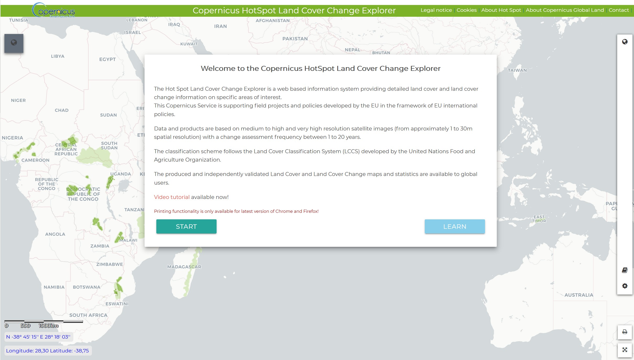
Thematic hotspot mapping
- Aims to provide tailored and more detailed information on specific areas of interest, known as hot-spots.
- Hotspots in the context of CLMS are prone to specific environmental challenges.
- Data and products are based on medium to high and very high resolution satellite images.
- Change assessment frequency between 1 to 20 years.
Copernicus HotSpot Land Cover Change Explorer
Reference data
- Provide satellite image mosaic in high and very high resolutions and reference datasets.
- This include satellite image mosaic from contributing missions covering the territory of Europe as well as Sentinel-2 image mosaic production at global level.
- It consists of reference datasets providing homogeneous pan-European coverage of some key geospatial themes, such as hydrography and elevation.
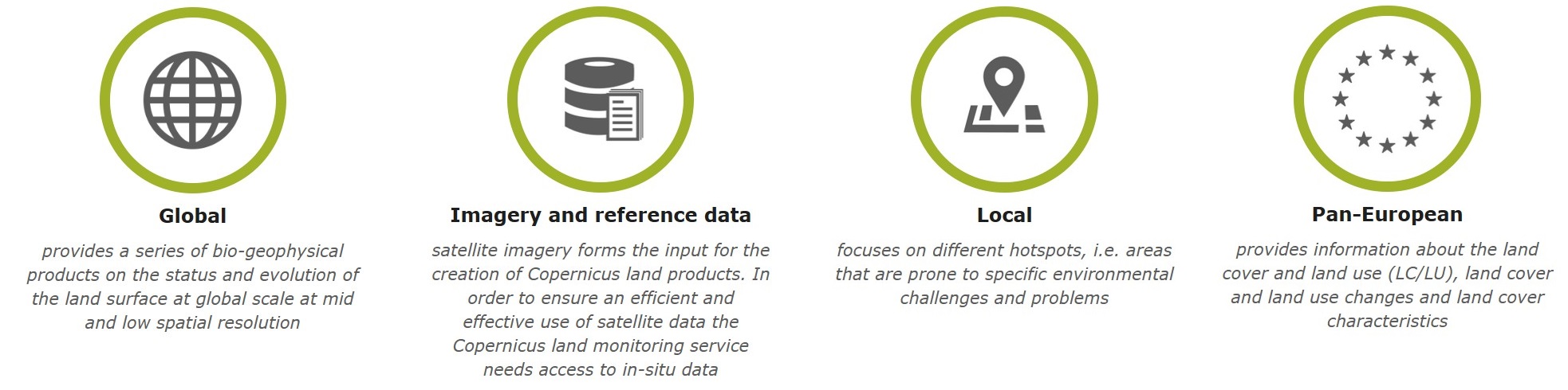
The Land Theme
- The land theme is divided into four main components:
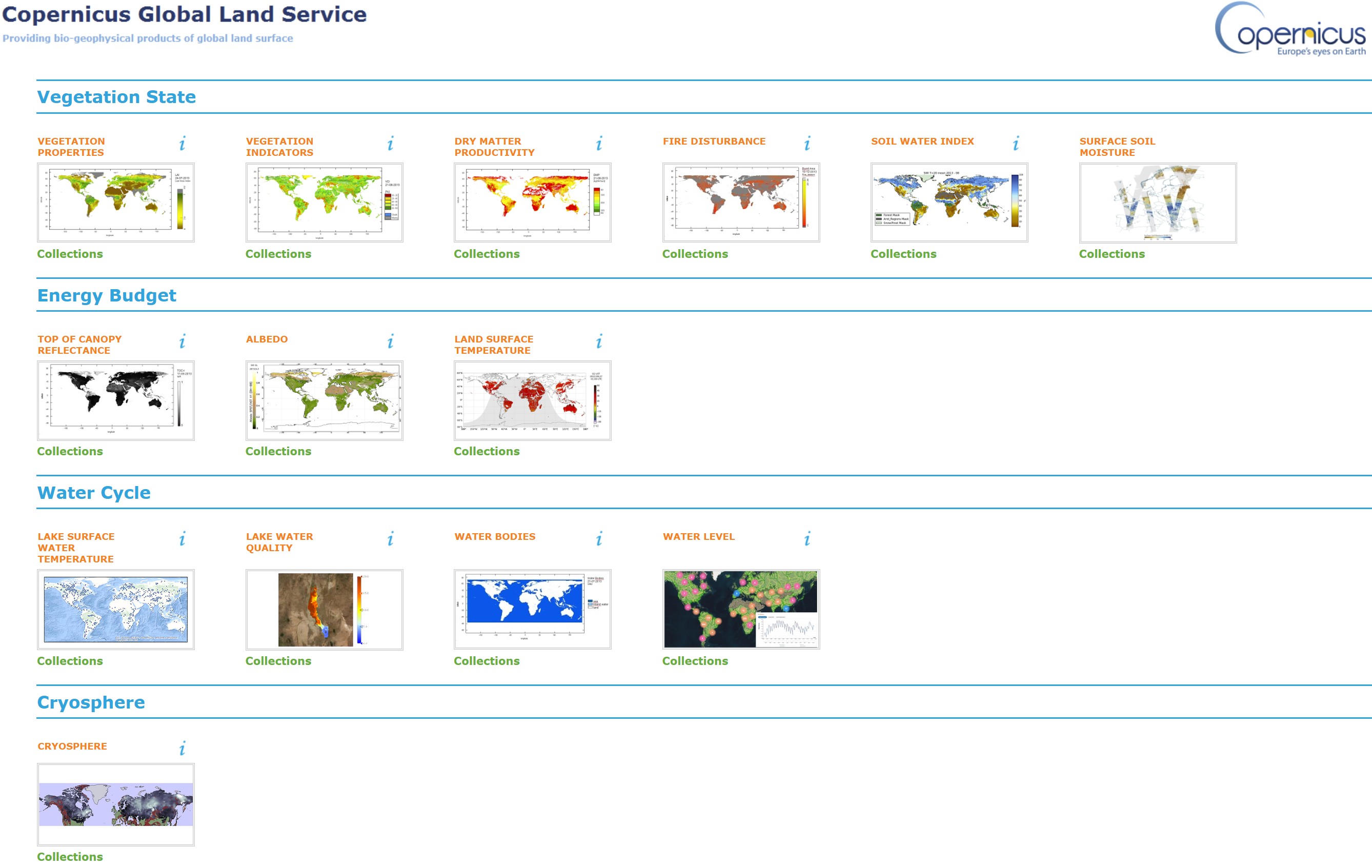
https://land.copernicus.vgt.vito.be/PDF/portal/Application.html#Home/
Copernicus Global Land Service - Vegetation
- To monitor the changes on continental biomes,
- In a timely manner, a set of biophysical variables describing:
- the state,
- the dynamism and
- the disturbances of the terrestrial vegetation.
Copernicus Global Land Service – Vegetation - Products
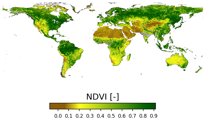
- Normalized difference vegetation index, and its derived condition and productivity indices.
- it is an indicator of the greenness of the biomes
- Leaf area index
- defined as half the total area of green elements of the canopy per unit horizontal ground area
- Fraction of green vegetation cover
- corresponds to the fraction of ground covered by green vegetation
- Vegetation condition index
- compares the current NDVI to the range of values observed in the same period in previous years
- Vegetation productivity index
- assesses the overall vegetation condition by referencing the current value of the NDVI with the long-term statistics for the same period
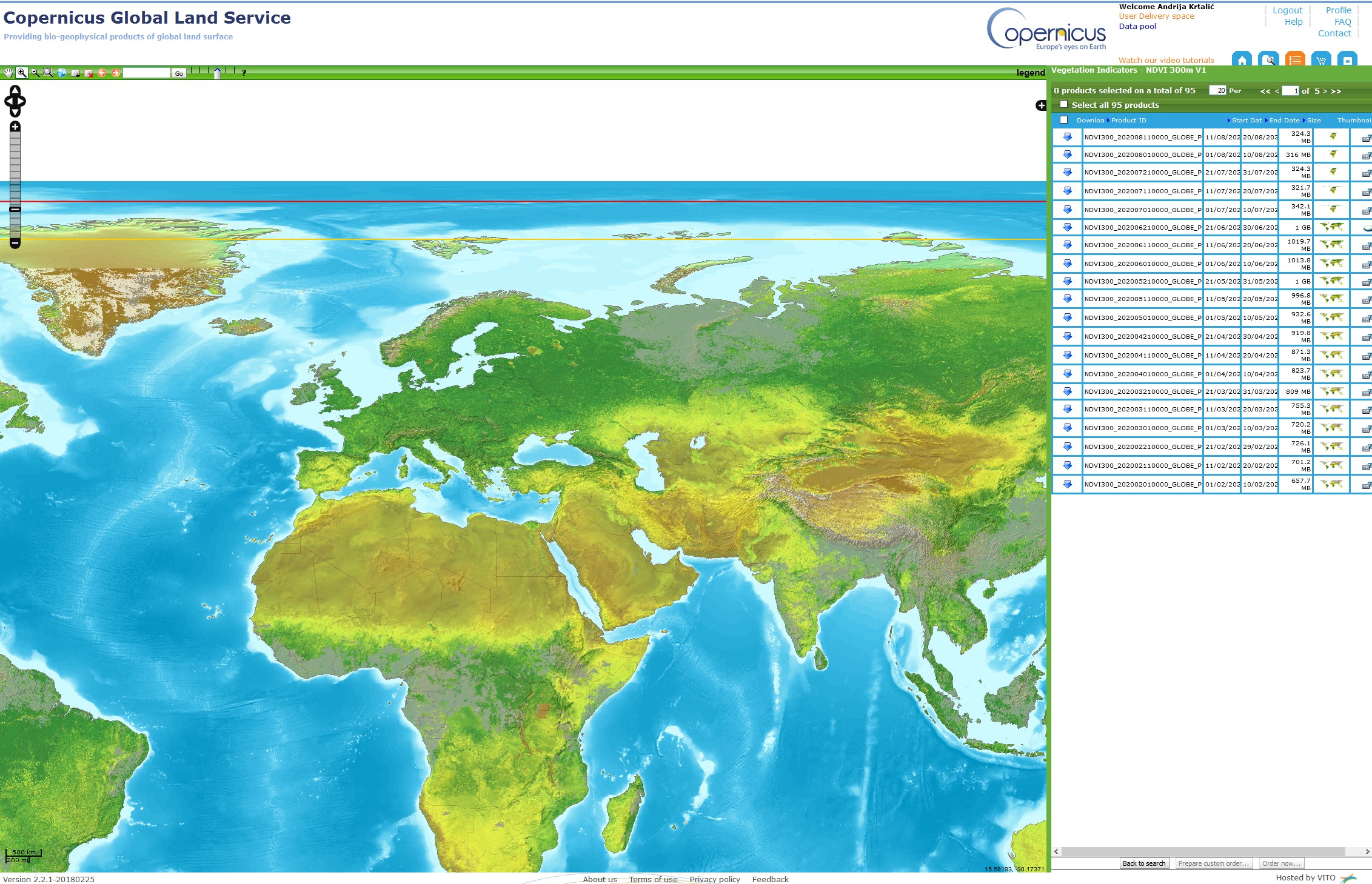
Browser for search of NDVI, VCI and VPI data
- To access the data (In all browsers), you need to register, here.
- The part of the browser where the type of product is selected.
- In these fields, the date and area for which the data is requested are selected.
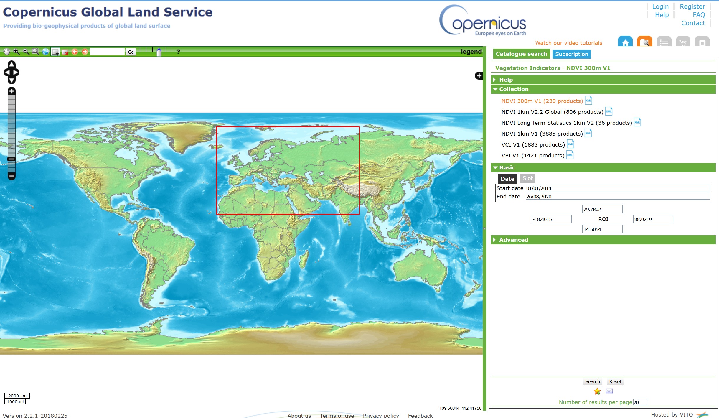
NDVI
Copernicus Global Land Service – Vegetation – Products 2
- Fraction of absorbed photosynthetically active radiation (FAPAR)
- quantifies the fraction of the solar radiation absorbed by live leaves for the photosynthesis activity
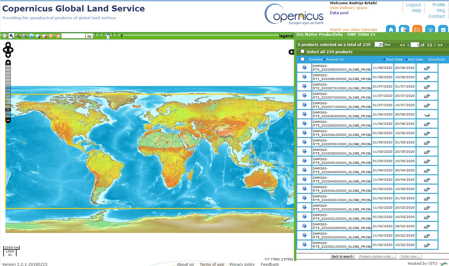
- Dry matter productivity features
- represents the overall growth rate or dry biomass increase of the vegetation and is directly related to ecosystem Net Primary Productivity (NPP)
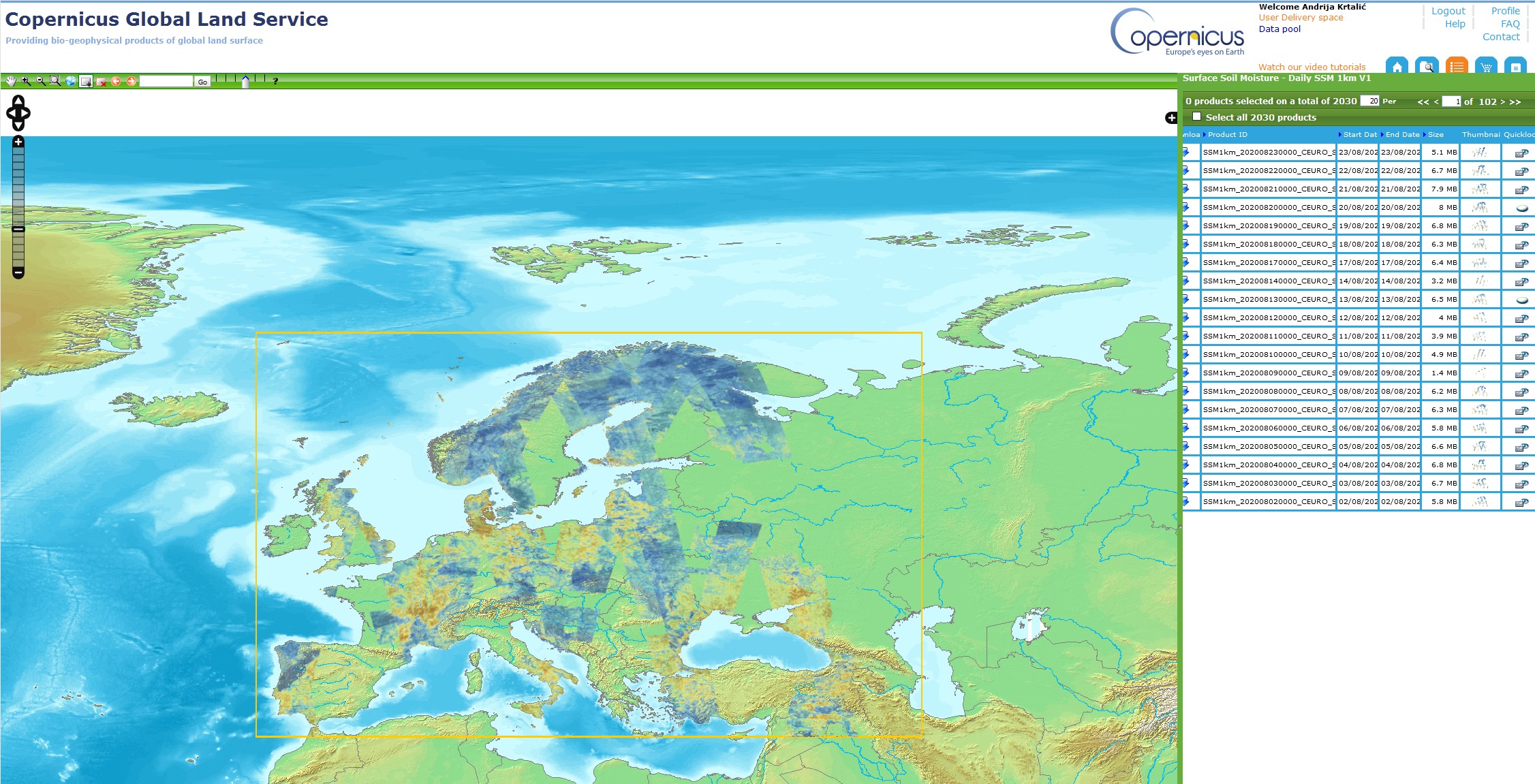
- Surface soil moisture
- relative water content of the top few centimeters soil,
- describing how wet or dry the soil is in its topmost layer, expressed in percent saturation.
- Soil water index
- quantifies the moisture condition at various depths in the soil
Dry matter productivity features
Surface soil moisture
Copernicus Global Land Service – Vegetation – Products 3
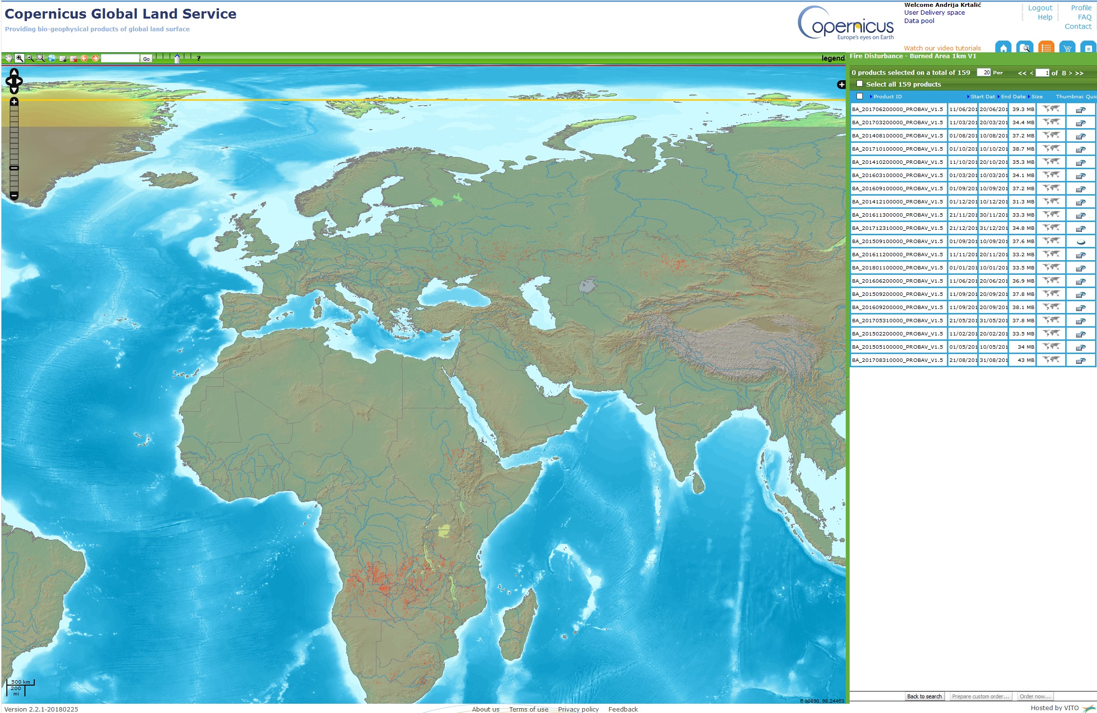
- Burnt area
- shows burned areas and provides information about the fire season
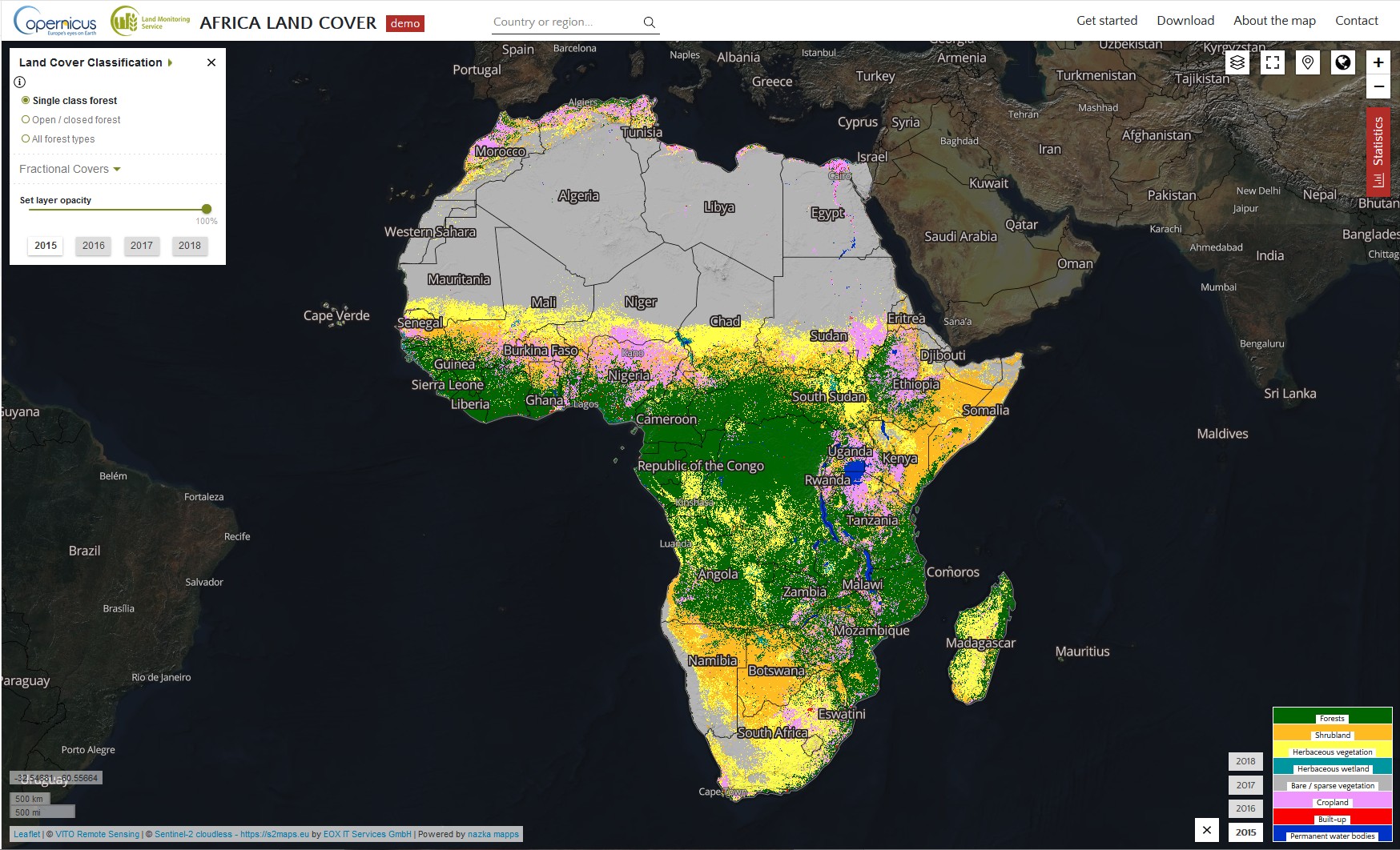
- Land cover
- land cover maps represent spatial information on different types (classes) of physical coverage of the Earth's surface, e.g. forests, grasslands, croplands, lakes, wetlands
- These biophysical products are useful for a wide range of thematic areas (the global crop monitoring, the food security applications; forest, water, and natural resources management; …)
Burnt areas
Land cover
Copernicus Global Land Service - Energy
- The incoming solar radiation controls the life on our planet Earth.
- To quantify the main responses of the continents to sun illumination, the Copernicus Global Land Service provides, in a timely manner, biophysical variables assessing the energy budget at the land surface.
Copernicus Global Land Service - Energy - Products
- Land Surface Temperature
- is the radiative skin temperature of the land surface, as measured in the direction of the remote sensor
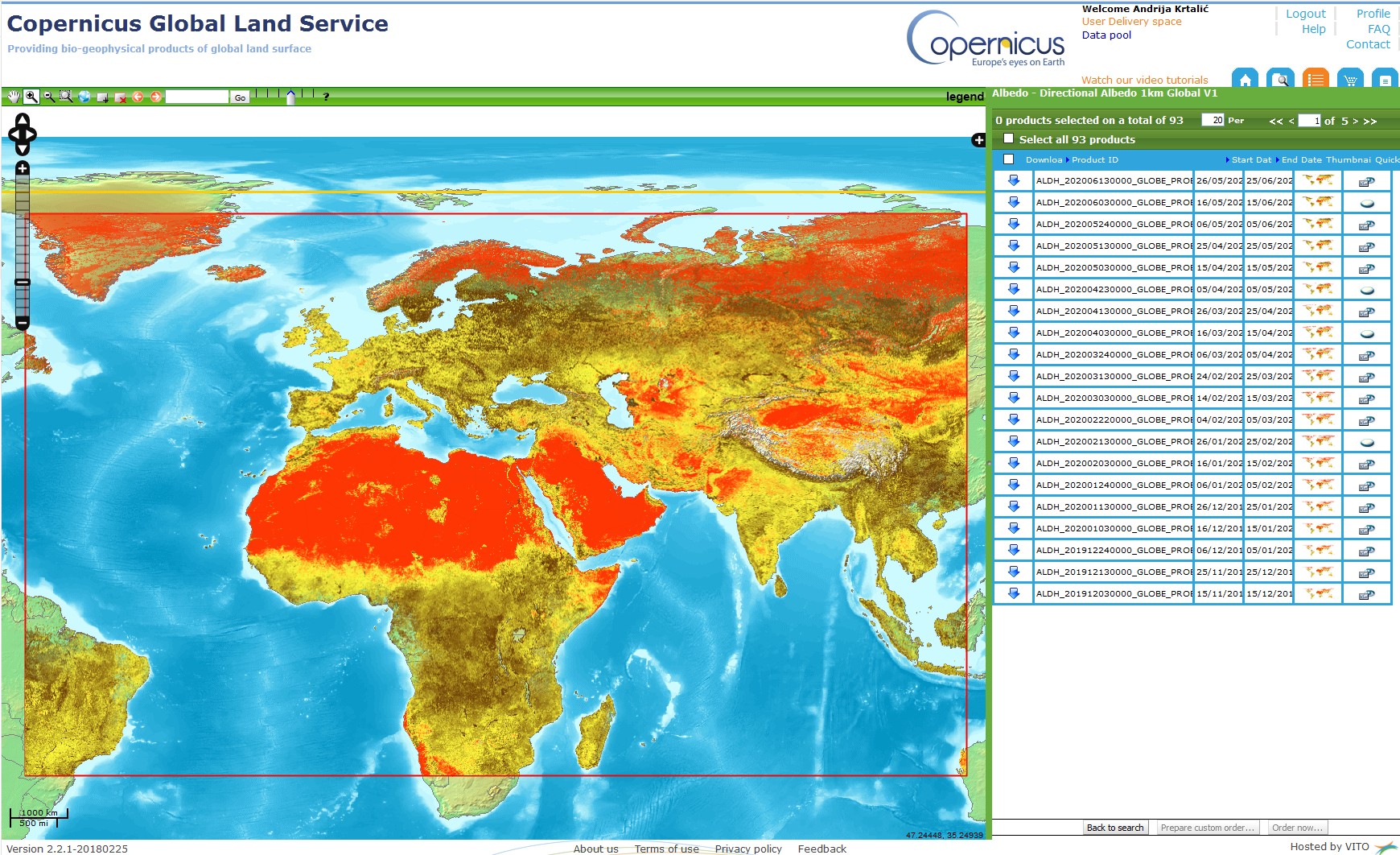
- Surface Albedo
- quantifies the fraction of the sunlight reflected by the surface of the Earth
- The directional albedo or directional-hemispherical reflectance (also called black-sky albedo)
- The hemispherical albedo or bi-hemispherical reflectance (also called white-sky albedo)
- Top Of Canopy Reflectances
- The Top-Of-Canopy spectral reflectance quantifies the fraction of the sunlight reflected by the surface of the Earth, in a given spectral band.
Albedo
Copernicus Global Land Service - Water
- To contribute to a better understanding of Earth’s water cycle, the Copernicus Global Land Service helps to monitor:
- Water surface temperature and water quality of medium and large-sized lakes.
- Water bodies - surface extent covered by water on a permanent basis
- Water level of lakes and rivers
- These products are useful for hydrological modelling as well as short- and medium-term meteorological forecasting since they control the water and heat exchanges between land and atmosphere.
- Provided for the full globe in a timely manner.
Copernicus Global Land Service - Cryosphere
- Snow cover has a strong influence on the Earth's radiation and energy balance.
- Snow cover parameters are crucial for the prediction of water balance, streamflow and river runoff in hydrological models and water resource management.
- The key cryosphere parameters monitored within the Copernicus Global Land Service:
- snow cover extent,
- snow water equivalent and
- lake ice extent.
Snow cover extent
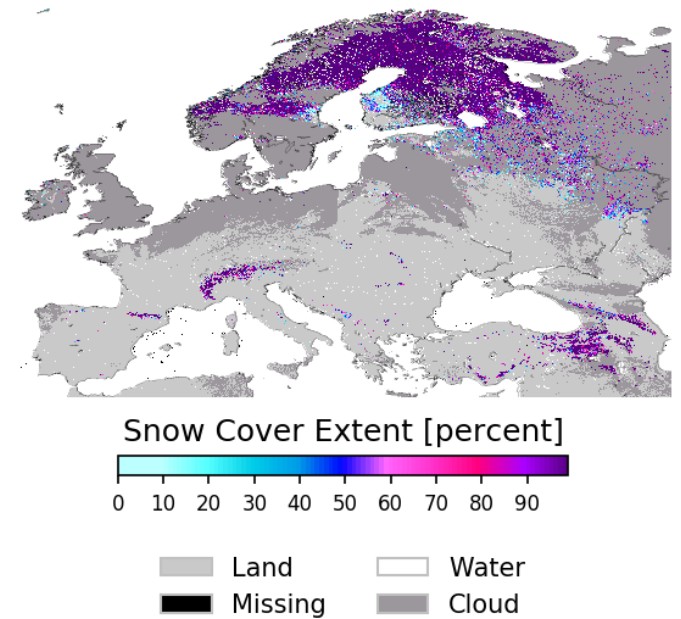
Snow Cover Extent over continental Europe, 500 m resolution, in late March 2017
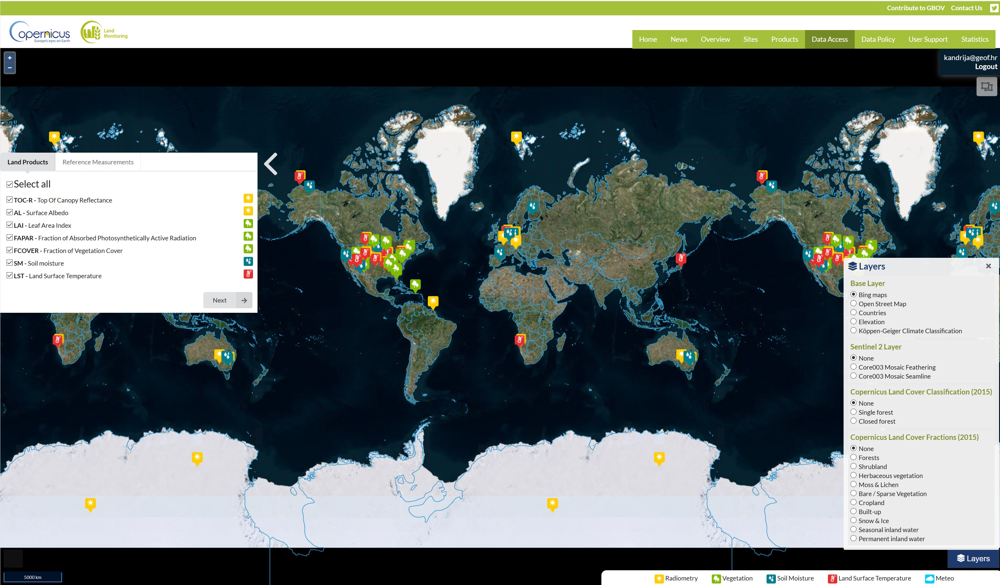
Ground-Based Observations for Validation (GBOV) of Copernicus Global Land Products
- The GBOV service provides multiple years of high quality in-situ measurements to validate 7 core land products:
- Top-of-canopy reflectances,
- Surface albedo,
- Fraction of Absorbed Photosynthetically Active Radiation,
- Leaf Area Index,
- Fraction of green Vegetation Cover,
- Land Surface Temperature and
- Soil Moisture
GBOV browser with accessible data
Pan-European Component
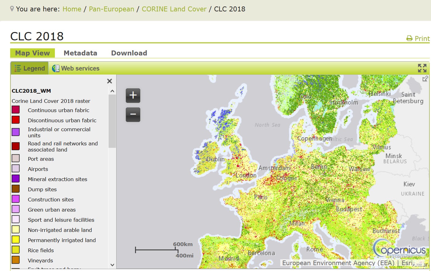
- Coordinated by the European Environment Agency (EEA) and produces land cover / land use (LC/LU) information in the CORINE
- Land Cover data,
- High Resolution Layers,
- Biophysical parameters and
- European Ground Motion Service.
-
The CORINE Land Cover is provided for 1990, 2000, 2006, 2012, and 2018. This vector-based dataset includes 44 land cover and land use classes. The example shows the classification for 2018.
European Ground Motion Service (EGMS)
- Aims to provide consistent, regular, standardised, harmonised and reliable information regarding natural and anthropogenic ground motion phenomena over Europe and across national borders.
- The main objective – measuring of ground displacements, including landslides and subsidence, as well as deformation of infrastructure.
- The EGMS will also provide tools for visualisation, interactive data exploration and user uptake elements for further ground investigations.
European Ground Motion Service (EGMS)
- The timetable for the EEA’s implementation of the EGMS.
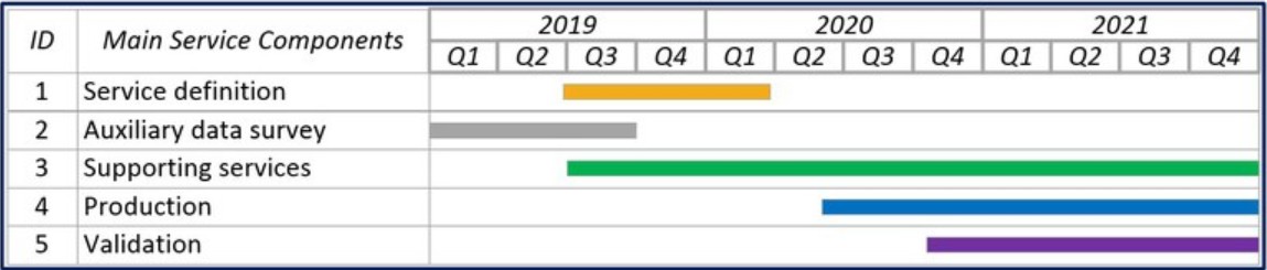
https://land.copernicus.eu/user-corner/technical-library/european-ground-motion-service
Local component
- Aims to provide specific and more detailed information that is complementary to the information obtained through the Pan-European component.
- Focus on different hotspots (areas that are prone to specific environmental challenges and problems).
- It will be based on very high resolution imagery (2,5 x 2,5 m pixels) in combination with other available datasets (high and medium resolution images) over the pan-European area.
Local Component - Products
- Urban Atlas
- provides pan-European comparable LC/LU data covering a number of Functional Urban Areas (mayor EU city area)
- Riparian Zone
- addresses LC/LU in areas along rivers, i.e. the riparian zones.
- Natura 2000
- the aim is to map LC/LU in a selection of grassland rich sites and to assess whether those selected sites are being effectively preserved as well as, if a decline of certain grassland habitat types is being halted.
- Coastal Zones
- LC/LU product maps from the European baseline a 10 km landwards buffer.
Imagery and Reference Data Component
- Copernicus land services need both satellite images and in-situ data in order to create reliable products and services.
- Satellite imagery forms the input for the creation of many information products and services.
- Many in-situ data are managed and made accessible at national level.
- Copernicus services and particularly CLMS relies on pan-European in-situ datasets created and/or coordinated at European level.
- This in-situ data used for verification and validation of several information services in the CLMS portfolio.
Imagery and Reference Data Component - Products
- EU-DEM
- (v1.0) is a digital surface model (DSM) of EEA39 countries representing the first surface as illuminated by the sensors
- EU-DEM v1.1 has not been validated yet
- EU-Hydro (River and Coastline)
- a dataset for all EEA39 countries providing a photo-interpreted river network, consistent of surface interpretation of water bodies (lakes and wide rivers)
-
- EU-Hydro has not been validated yet
- LUCAS Survey
- carried out by EUROSTAT on a three-yearly basis since 2006, focuses on the state and the dynamics of changes in land use and cover in the European Union. The survey is carried out in-situ
- European Image Mosaics
- High Resolution satellite imagery forms the input for the creation of many information products and services
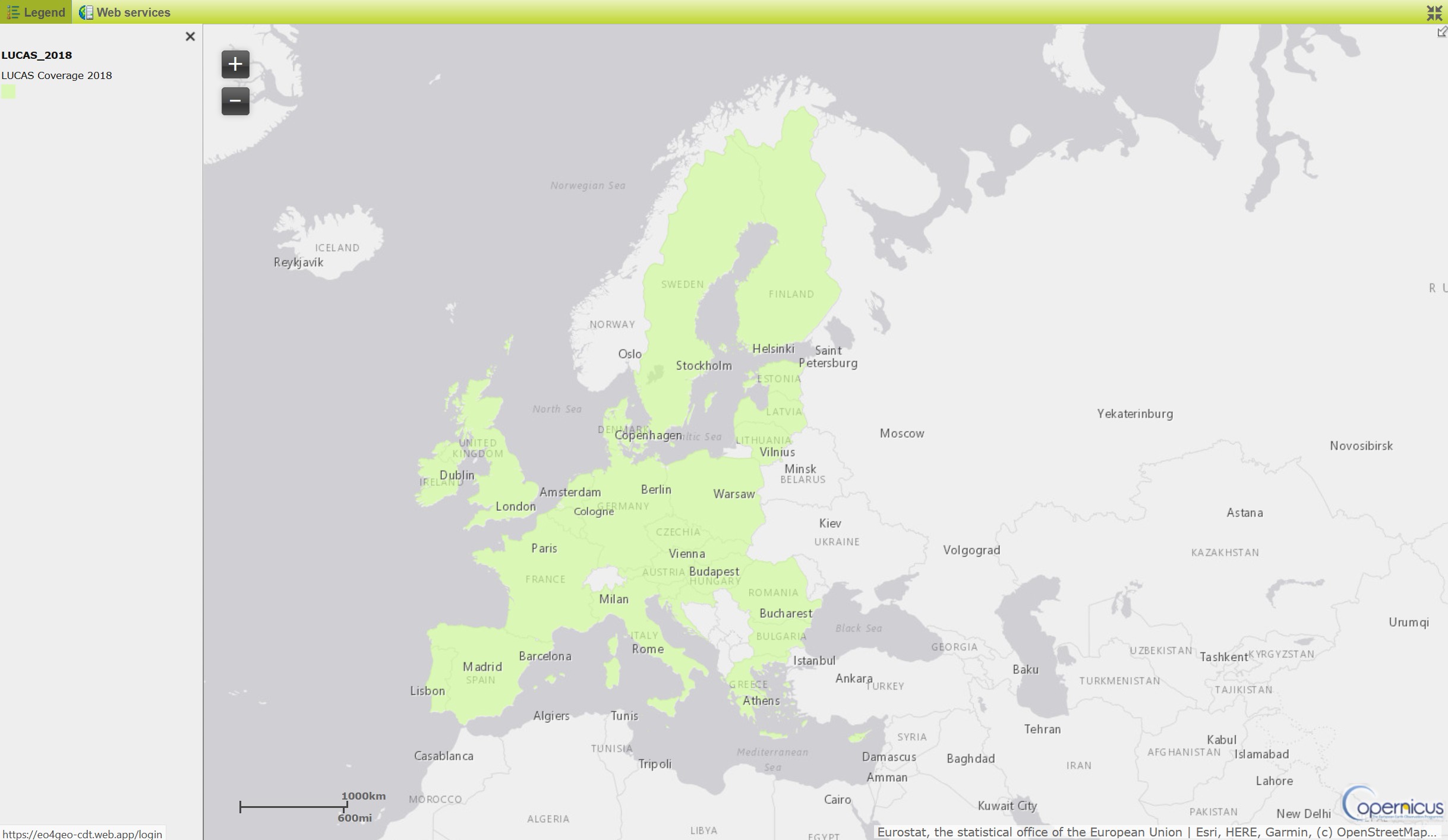
Green - the area on which in-situ measurements were performed
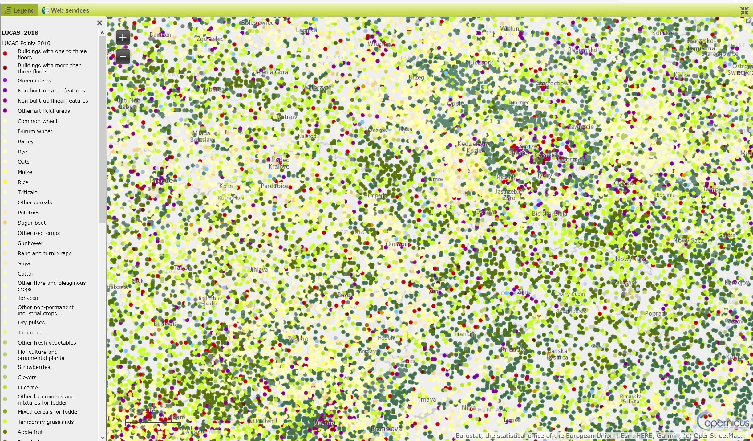
Multicolored points - locations where specific in-situ measurements were performed
Conclusions and take-aways
- soon to be added
Reference list
Barbara Hofer (2018). Innovation in geoprocessing for a Digital Earth. International Journal in Digital Earth.
10.1080/17538947.2017.1379154